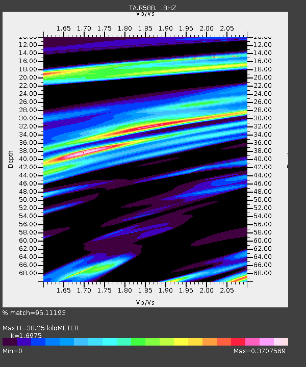
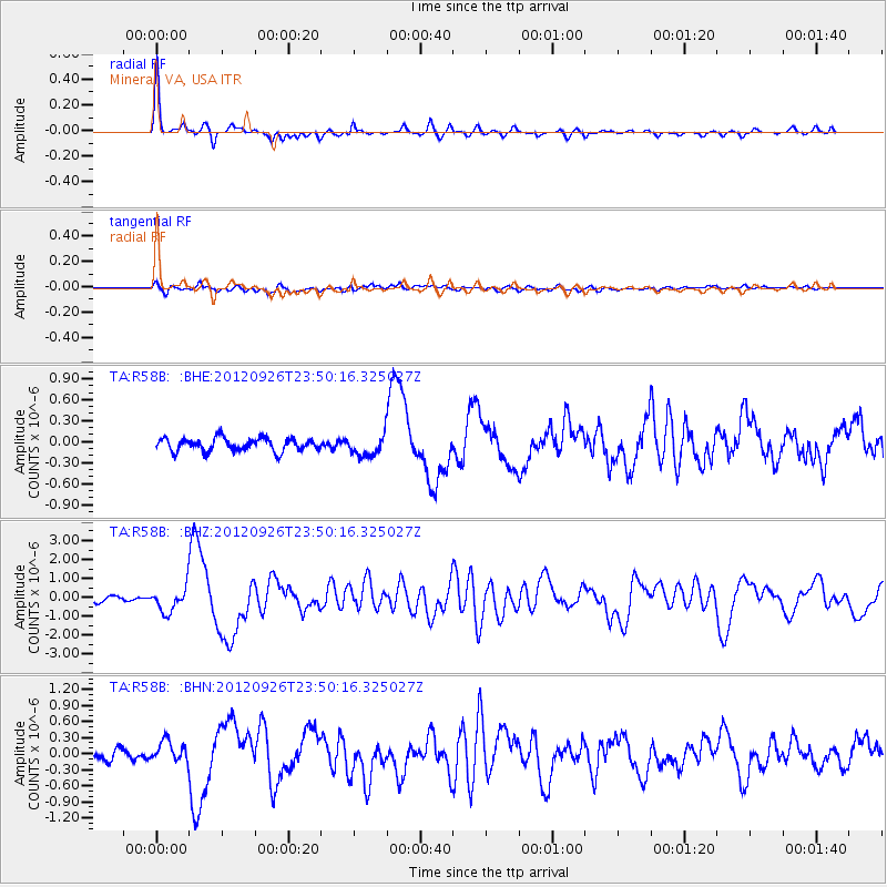
R58B Mineral, VA, USA - Earthquake Result Viewer

Earthquake location: Andreanof Islands, Aleutian Is.
Earthquake latitude/longitude: 51.6/-178.3
Earthquake time(UTC): 2012/09/26 (270) 23:39:55 GMT
Earthquake Depth: 16 km
Earthquake Magnitude: 6.3 MB, 6.5 MS, 6.4 MW, 6.4 MW
Earthquake Catalog/Contributor: WHDF/NEIC
Network: TA USArray Transportable Network (new EarthScope stations)
Station: R58B Mineral, VA, USA
Lat/Lon: 37.96 N/77.88 W
Elevation: 116 m
Distance: 67.1 deg
Az: 57.574 deg
Baz: 318.227 deg
Ray Param: 0.057185125
Estimated Moho Depth: 38.25 km
Estimated Crust Vp/Vs: 1.70
Assumed Crust Vp: 6.565 km/s
Estimated Crust Vs: 3.867 km/s
Estimated Crust Poisson's Ratio: 0.23
Radial Match: 95.11193 %
Radial Bump: 291
Transverse Match: 64.35468 %
Transverse Bump: 400
SOD ConfigId: 478790
Insert Time: 2013-02-22 23:53:28.026 +0000
GWidth: 2.5
Max Bumps: 400
Tol: 0.001

Signal To Noise

ChannelStoNSTALTA
TA:R58B: :BHZ:20120926T23:50:16.325027Z5.5621846.451758E-71.1599326E-7
TA:R58B: :BHN:20120926T23:50:16.325027Z1.94795161.91614E-79.8366925E-8
TA:R58B: :BHE:20120926T23:50:16.325027Z1.66069211.5287218E-79.205329E-8
Arrivals
Ps4.2 SECOND
PpPs15 SECOND
PsPs/PpSs19 SECOND