
N47A Urbana, IN, USA - Earthquake Result Viewer
| ||||||||||||||||||
| ||||||||||||||||||
| ||||||||||||||||||
|
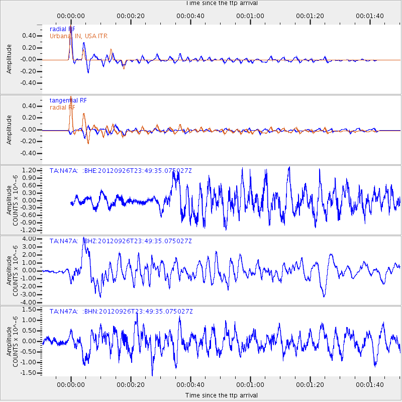
Signal To Noise
| Channel | StoN | STA | LTA |
| TA:N47A: :BHZ:20120926T23:49:35.075027Z | 13.396618 | 1.6746691E-6 | 1.2500686E-7 |
| TA:N47A: :BHN:20120926T23:49:35.075027Z | 3.3928916 | 4.5454678E-7 | 1.3397032E-7 |
| TA:N47A: :BHE:20120926T23:49:35.075027Z | 3.1292162 | 4.9460226E-7 | 1.5805948E-7 |
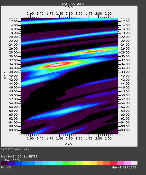
| Arrivals | |
| Ps | 4.3 SECOND |
| PpPs | 14 SECOND |
| PsPs/PpSs | 18 SECOND |

