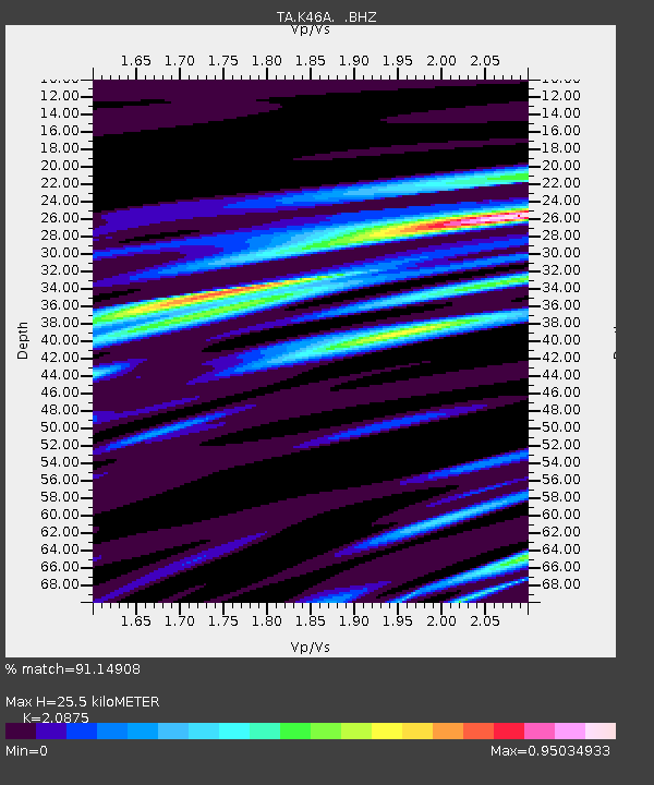
K46A Dorr, MI, USA - Earthquake Result Viewer
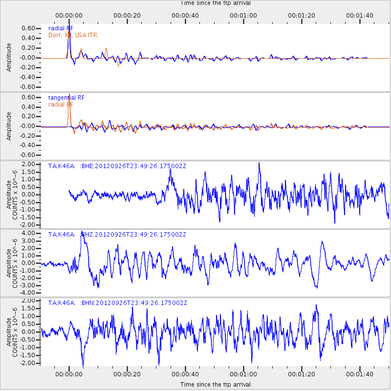
Earthquake location: Andreanof Islands, Aleutian Is.
Earthquake latitude/longitude: 51.6/-178.3
Earthquake time(UTC): 2012/09/26 (270) 23:39:55 GMT
Earthquake Depth: 16 km
Earthquake Magnitude: 6.3 MB, 6.5 MS, 6.4 MW, 6.4 MW
Earthquake Catalog/Contributor: WHDF/NEIC
Network: TA USArray Transportable Network (new EarthScope stations)
Station: K46A Dorr, MI, USA
Lat/Lon: 42.69 N/85.78 W
Elevation: 213 m
Distance: 59.5 deg
Az: 58.77 deg
Baz: 313.661 deg
Ray Param: 0.06214552
Estimated Moho Depth: 25.5 km
Estimated Crust Vp/Vs: 2.09
Assumed Crust Vp: 6.483 km/s
Estimated Crust Vs: 3.105 km/s
Estimated Crust Poisson's Ratio: 0.35
Radial Match: 91.14908 %
Radial Bump: 400
Transverse Match: 71.83495 %
Transverse Bump: 400
SOD ConfigId: 478790
Insert Time: 2013-02-22 23:54:28.104 +0000
GWidth: 2.5
Max Bumps: 400
Tol: 0.001

Signal To Noise

ChannelStoNSTALTA
TA:K46A: :BHZ:20120926T23:49:26.175002Z9.8314291.6488495E-61.6771209E-7
TA:K46A: :BHN:20120926T23:49:26.175002Z3.78714016.437745E-71.6998963E-7
TA:K46A: :BHE:20120926T23:49:26.175002Z3.2082235.5083746E-71.7169549E-7
Arrivals
Ps4.5 SECOND
PpPs12 SECOND
PsPs/PpSs16 SECOND