J46A Howard City, MI, USA - Earthquake Result Viewer
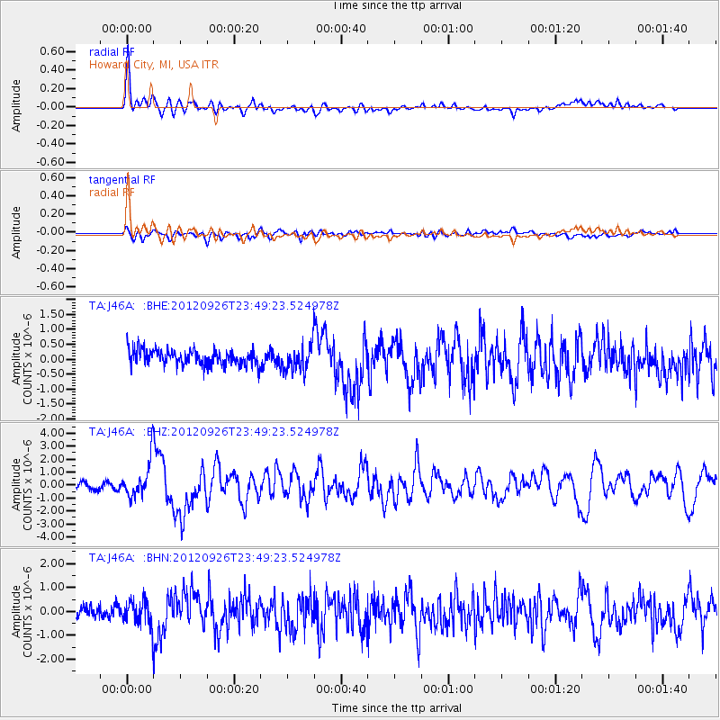
Earthquake location: Andreanof Islands, Aleutian Is.
Earthquake latitude/longitude: 51.6/-178.3
Earthquake time(UTC): 2012/09/26 (270) 23:39:55 GMT
Earthquake Depth: 16 km
Earthquake Magnitude: 6.3 MB, 6.5 MS, 6.4 MW, 6.4 MW
Earthquake Catalog/Contributor: WHDF/NEIC
Network: TA USArray Transportable Network (new EarthScope stations)
Station: J46A Howard City, MI, USA
Lat/Lon: 43.35 N/85.65 W
Elevation: 275 m
Distance: 59.1 deg
Az: 58.132 deg
Baz: 313.428 deg
Ray Param: 0.06239871
Estimated Moho Depth: 10.5 km
Estimated Crust Vp/Vs: 2.10
Assumed Crust Vp: 6.483 km/s
Estimated Crust Vs: 3.091 km/s
Estimated Crust Poisson's Ratio: 0.35
Radial Match: 88.407616 %
Radial Bump: 400
Transverse Match: 70.11065 %
Transverse Bump: 400
SOD ConfigId: 478790
Insert Time: 2013-02-22 23:54:49.044 +0000
GWidth: 2.5
Max Bumps: 400
Tol: 0.001

Signal To Noise

ChannelStoNSTALTA
TA:J46A: :BHZ:20120926T23:49:23.524978Z6.24457261.4249946E-62.281973E-7
TA:J46A: :BHN:20120926T23:49:23.524978Z1.96159365.061449E-72.580274E-7
TA:J46A: :BHE:20120926T23:49:23.524978Z1.70997674.3934386E-72.5692972E-7
Arrivals
Ps1.9 SECOND
PpPs4.8 SECOND
PsPs/PpSs6.7 SECOND