K48A Perry, MI, USA - Earthquake Result Viewer
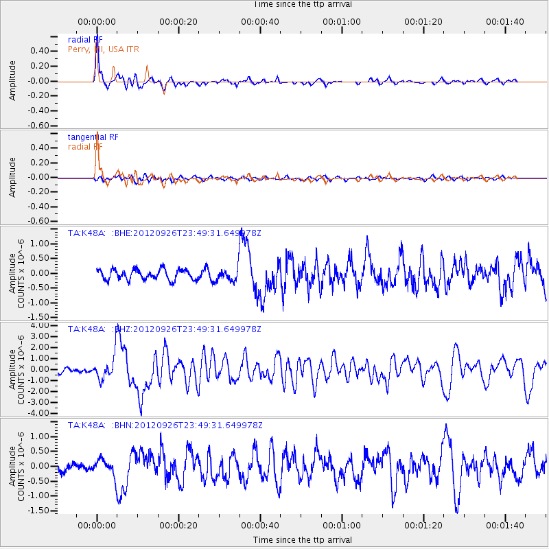
Earthquake location: Andreanof Islands, Aleutian Is.
Earthquake latitude/longitude: 51.6/-178.3
Earthquake time(UTC): 2012/09/26 (270) 23:39:55 GMT
Earthquake Depth: 16 km
Earthquake Magnitude: 6.3 MB, 6.5 MS, 6.4 MW, 6.4 MW
Earthquake Catalog/Contributor: WHDF/NEIC
Network: TA USArray Transportable Network (new EarthScope stations)
Station: K48A Perry, MI, USA
Lat/Lon: 42.80 N/84.12 W
Elevation: 273 m
Distance: 60.3 deg
Az: 57.689 deg
Baz: 314.244 deg
Ray Param: 0.061621103
Estimated Moho Depth: 15.75 km
Estimated Crust Vp/Vs: 1.60
Assumed Crust Vp: 6.483 km/s
Estimated Crust Vs: 4.052 km/s
Estimated Crust Poisson's Ratio: 0.18
Radial Match: 92.53148 %
Radial Bump: 400
Transverse Match: 59.396835 %
Transverse Bump: 400
SOD ConfigId: 478790
Insert Time: 2013-02-22 23:55:18.159 +0000
GWidth: 2.5
Max Bumps: 400
Tol: 0.001

Signal To Noise

ChannelStoNSTALTA
TA:K48A: :BHZ:20120926T23:49:31.649978Z7.56998351.0934069E-61.444398E-7
TA:K48A: :BHN:20120926T23:49:31.649978Z2.15289332.858339E-71.3276733E-7
TA:K48A: :BHE:20120926T23:49:31.649978Z1.29705132.2580103E-71.7408797E-7
Arrivals
Ps1.5 SECOND
PpPs6.0 SECOND
PsPs/PpSs7.5 SECOND