UMAT Pilot Rock, OR, USA - Earthquake Result Viewer
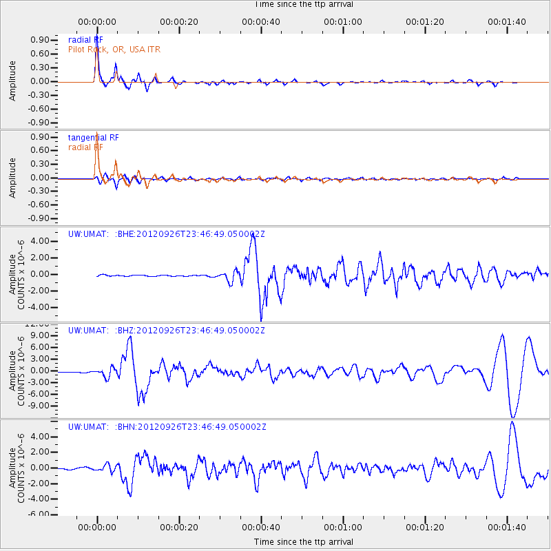
Earthquake location: Andreanof Islands, Aleutian Is.
Earthquake latitude/longitude: 51.6/-178.3
Earthquake time(UTC): 2012/09/26 (270) 23:39:55 GMT
Earthquake Depth: 16 km
Earthquake Magnitude: 6.3 MB, 6.5 MS, 6.4 MW, 6.4 MW
Earthquake Catalog/Contributor: WHDF/NEIC
Network: UW Pacific Northwest Regional Seismic Network
Station: UMAT Pilot Rock, OR, USA
Lat/Lon: 45.29 N/118.96 W
Elevation: 1318 m
Distance: 38.9 deg
Az: 75.195 deg
Baz: 301.308 deg
Ray Param: 0.07527654
Estimated Moho Depth: 19.75 km
Estimated Crust Vp/Vs: 2.10
Assumed Crust Vp: 6.571 km/s
Estimated Crust Vs: 3.133 km/s
Estimated Crust Poisson's Ratio: 0.35
Radial Match: 91.22905 %
Radial Bump: 255
Transverse Match: 75.30306 %
Transverse Bump: 400
SOD ConfigId: 478790
Insert Time: 2013-02-22 23:56:19.317 +0000
GWidth: 2.5
Max Bumps: 400
Tol: 0.001

Signal To Noise

ChannelStoNSTALTA
UW:UMAT: :BHZ:20120926T23:46:49.050002Z14.0945161.150052E-68.159571E-8
UW:UMAT: :BHN:20120926T23:46:49.050002Z2.76856884.305195E-71.5550255E-7
UW:UMAT: :BHE:20120926T23:46:49.050002Z9.188166.113837E-76.654039E-8
Arrivals
Ps3.5 SECOND
PpPs8.7 SECOND
PsPs/PpSs12 SECOND