You are here: Home > Network List > IW - Intermountain West Stations List
> Station DLMT Dillon, Montana, USA > Earthquake Result Viewer
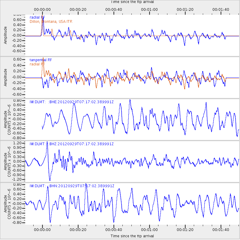
DLMT Dillon, Montana, USA - Earthquake Result Viewer
*The percent match for this event was below the threshold and hence no stack was calculated.
| Earthquake location: |
Near Coast Of Guerrero, Mexico |
| Earthquake latitude/longitude: |
16.3/-98.4 |
| Earthquake time(UTC): |
2012/09/29 (273) 07:11:12 GMT |
| Earthquake Depth: |
12 km |
| Earthquake Magnitude: |
5.5 MW, 4.9 MS, 5.3 MB, 5.4 MW |
| Earthquake Catalog/Contributor: |
WHDF/NEIC |
|
| Network: |
IW Intermountain West |
| Station: |
DLMT Dillon, Montana, USA |
| Lat/Lon: |
45.36 N/112.60 W |
| Elevation: |
1569 m |
|
| Distance: |
31.3 deg |
| Az: |
340.569 deg |
| Baz: |
153.055 deg |
| Ray Param: |
$rayparam |
*The percent match for this event was below the threshold and hence was not used in the summary stack. |
|
| Radial Match: |
65.01792 % |
| Radial Bump: |
400 |
| Transverse Match: |
71.64229 % |
| Transverse Bump: |
400 |
| SOD ConfigId: |
478790 |
| Insert Time: |
2013-02-23 00:17:44.879 +0000 |
| GWidth: |
2.5 |
| Max Bumps: |
400 |
| Tol: |
0.001 |
|
Signal To Noise
| Channel | StoN | STA | LTA |
| IW:DLMT: :BHZ:20120929T07:17:02.389991Z | 4.4254704 | 6.745271E-7 | 1.524193E-7 |
| IW:DLMT: :BHN:20120929T07:17:02.389991Z | 2.3036008 | 3.940801E-7 | 1.7107135E-7 |
| IW:DLMT: :BHE:20120929T07:17:02.389991Z | 0.89598143 | 2.6980658E-7 | 3.0112963E-7 |
| Arrivals |
| Ps | |
| PpPs | |
| PsPs/PpSs | |


