You are here: Home > Network List > TA - USArray Transportable Network (new EarthScope stations) Stations List
> Station D53A Lac Vacive, Pontiac, Mrc, QC, CAN > Earthquake Result Viewer
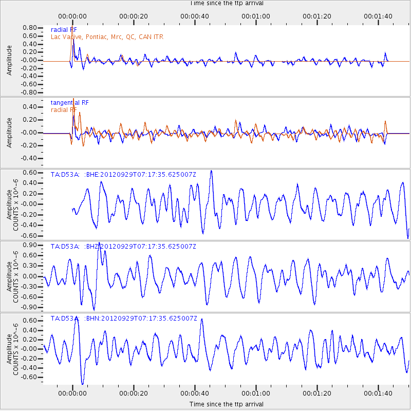
D53A Lac Vacive, Pontiac, Mrc, QC, CAN - Earthquake Result Viewer
*The percent match for this event was below the threshold and hence no stack was calculated.
| Earthquake location: |
Near Coast Of Guerrero, Mexico |
| Earthquake latitude/longitude: |
16.3/-98.4 |
| Earthquake time(UTC): |
2012/09/29 (273) 07:11:12 GMT |
| Earthquake Depth: |
12 km |
| Earthquake Magnitude: |
5.5 MW, 4.9 MS, 5.3 MB, 5.4 MW |
| Earthquake Catalog/Contributor: |
WHDF/NEIC |
|
| Network: |
TA USArray Transportable Network (new EarthScope stations) |
| Station: |
D53A Lac Vacive, Pontiac, Mrc, QC, CAN |
| Lat/Lon: |
47.08 N/77.70 W |
| Elevation: |
347 m |
|
| Distance: |
35.2 deg |
| Az: |
24.8 deg |
| Baz: |
216.112 deg |
| Ray Param: |
$rayparam |
*The percent match for this event was below the threshold and hence was not used in the summary stack. |
|
| Radial Match: |
60.02691 % |
| Radial Bump: |
400 |
| Transverse Match: |
51.08138 % |
| Transverse Bump: |
391 |
| SOD ConfigId: |
478790 |
| Insert Time: |
2013-02-23 00:22:48.686 +0000 |
| GWidth: |
2.5 |
| Max Bumps: |
400 |
| Tol: |
0.001 |
|
Signal To Noise
| Channel | StoN | STA | LTA |
| TA:D53A: :BHZ:20120929T07:17:35.625007Z | 2.0199752 | 3.7214164E-7 | 1.8423079E-7 |
| TA:D53A: :BHN:20120929T07:17:35.625007Z | 2.6342943 | 4.602333E-7 | 1.7470839E-7 |
| TA:D53A: :BHE:20120929T07:17:35.625007Z | 0.9411629 | 2.0301908E-7 | 2.1571088E-7 |
| Arrivals |
| Ps | |
| PpPs | |
| PsPs/PpSs | |


