You are here: Home > Network List > TA - USArray Transportable Network (new EarthScope stations) Stations List
> Station MDND Maddock, ND, USA > Earthquake Result Viewer
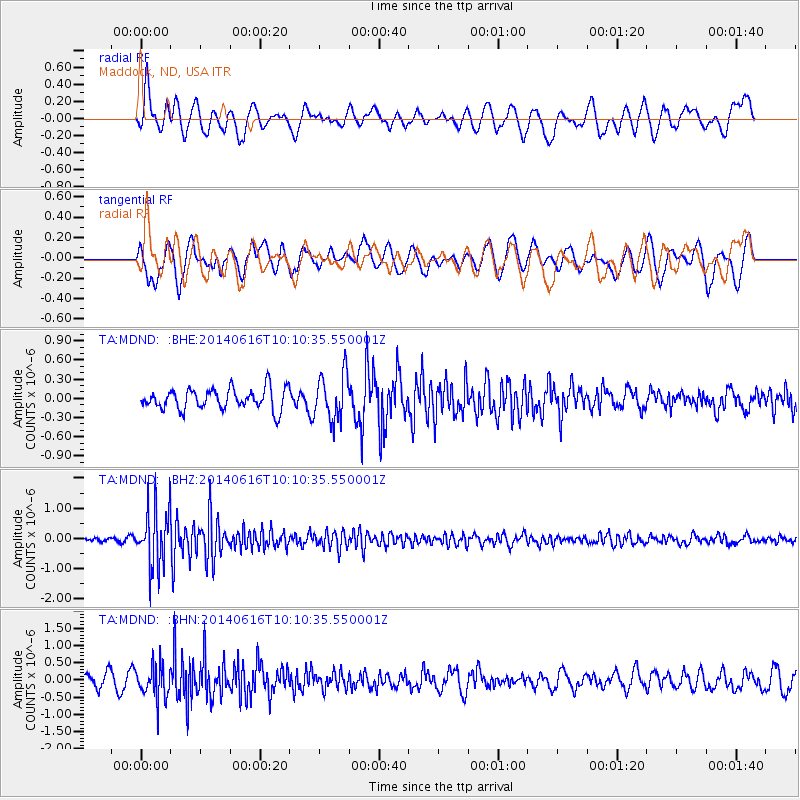
MDND Maddock, ND, USA - Earthquake Result Viewer
*The percent match for this event was below the threshold and hence no stack was calculated.
| Earthquake location: |
Mexico-Guatemala Border Region |
| Earthquake latitude/longitude: |
15.3/-91.9 |
| Earthquake time(UTC): |
2014/06/16 (167) 10:04:30 GMT |
| Earthquake Depth: |
10 km |
| Earthquake Magnitude: |
5.0 MW |
| Earthquake Catalog/Contributor: |
ISC/ISC |
|
| Network: |
TA USArray Transportable Network (new EarthScope stations) |
| Station: |
MDND Maddock, ND, USA |
| Lat/Lon: |
47.85 N/99.60 W |
| Elevation: |
479 m |
|
| Distance: |
33.1 deg |
| Az: |
350.536 deg |
| Baz: |
166.375 deg |
| Ray Param: |
$rayparam |
*The percent match for this event was below the threshold and hence was not used in the summary stack. |
|
| Radial Match: |
58.66158 % |
| Radial Bump: |
400 |
| Transverse Match: |
54.492424 % |
| Transverse Bump: |
400 |
| SOD ConfigId: |
3390531 |
| Insert Time: |
2019-04-12 07:24:09.104 +0000 |
| GWidth: |
2.5 |
| Max Bumps: |
400 |
| Tol: |
0.001 |
|
Signal To Noise
| Channel | StoN | STA | LTA |
| TA:MDND: :BHZ:20140616T10:10:35.550001Z | 8.70414 | 9.885227E-7 | 1.13569264E-7 |
| TA:MDND: :BHN:20140616T10:10:35.550001Z | 1.8421003 | 4.886124E-7 | 2.6524745E-7 |
| TA:MDND: :BHE:20140616T10:10:35.550001Z | 2.224484 | 3.639293E-7 | 1.6360167E-7 |
| Arrivals |
| Ps | |
| PpPs | |
| PsPs/PpSs | |


