You are here: Home > Network List > US - United States National Seismic Network Stations List
> Station GLMI Grayling, Michigan, USA > Earthquake Result Viewer
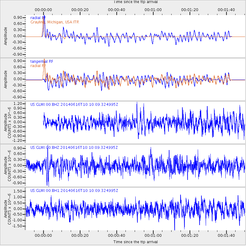
GLMI Grayling, Michigan, USA - Earthquake Result Viewer
*The percent match for this event was below the threshold and hence no stack was calculated.
| Earthquake location: |
Mexico-Guatemala Border Region |
| Earthquake latitude/longitude: |
15.3/-91.9 |
| Earthquake time(UTC): |
2014/06/16 (167) 10:04:30 GMT |
| Earthquake Depth: |
10 km |
| Earthquake Magnitude: |
5.0 MW |
| Earthquake Catalog/Contributor: |
ISC/ISC |
|
| Network: |
US United States National Seismic Network |
| Station: |
GLMI Grayling, Michigan, USA |
| Lat/Lon: |
44.82 N/84.62 W |
| Elevation: |
387 m |
|
| Distance: |
30.1 deg |
| Az: |
10.434 deg |
| Baz: |
194.218 deg |
| Ray Param: |
$rayparam |
*The percent match for this event was below the threshold and hence was not used in the summary stack. |
|
| Radial Match: |
51.483433 % |
| Radial Bump: |
400 |
| Transverse Match: |
53.198032 % |
| Transverse Bump: |
400 |
| SOD ConfigId: |
3390531 |
| Insert Time: |
2019-04-12 07:24:35.490 +0000 |
| GWidth: |
2.5 |
| Max Bumps: |
400 |
| Tol: |
0.001 |
|
Signal To Noise
| Channel | StoN | STA | LTA |
| US:GLMI:00:BHZ:20140616T10:10:09.324995Z | 2.625074 | 4.2272714E-7 | 1.610344E-7 |
| US:GLMI:00:BH1:20140616T10:10:09.324995Z | 1.1189595 | 3.6896384E-7 | 3.297383E-7 |
| US:GLMI:00:BH2:20140616T10:10:09.324995Z | 1.1538887 | 2.8185383E-7 | 2.4426433E-7 |
| Arrivals |
| Ps | |
| PpPs | |
| PsPs/PpSs | |


