You are here: Home > Network List > US - United States National Seismic Network Stations List
> Station LKWY Lake (Yellowstone--Lake), Wyoming, USA > Earthquake Result Viewer
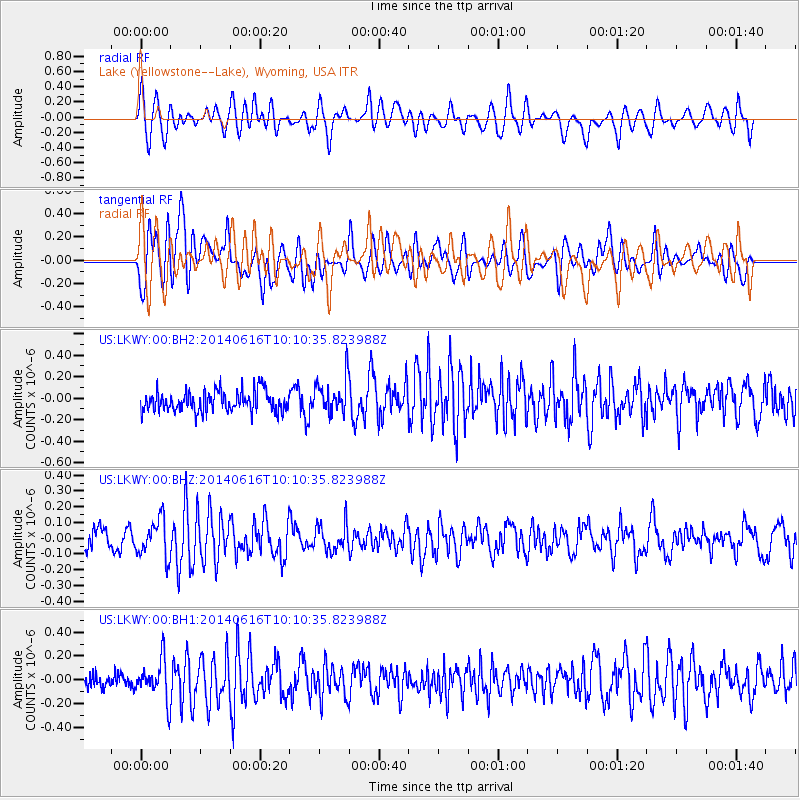
LKWY Lake (Yellowstone--Lake), Wyoming, USA - Earthquake Result Viewer
*The percent match for this event was below the threshold and hence no stack was calculated.
| Earthquake location: |
Mexico-Guatemala Border Region |
| Earthquake latitude/longitude: |
15.3/-91.9 |
| Earthquake time(UTC): |
2014/06/16 (167) 10:04:30 GMT |
| Earthquake Depth: |
10 km |
| Earthquake Magnitude: |
5.0 MW |
| Earthquake Catalog/Contributor: |
ISC/ISC |
|
| Network: |
US United States National Seismic Network |
| Station: |
LKWY Lake (Yellowstone--Lake), Wyoming, USA |
| Lat/Lon: |
44.57 N/110.40 W |
| Elevation: |
2424 m |
|
| Distance: |
33.1 deg |
| Az: |
335.531 deg |
| Baz: |
145.999 deg |
| Ray Param: |
$rayparam |
*The percent match for this event was below the threshold and hence was not used in the summary stack. |
|
| Radial Match: |
60.356354 % |
| Radial Bump: |
400 |
| Transverse Match: |
61.511124 % |
| Transverse Bump: |
400 |
| SOD ConfigId: |
3390531 |
| Insert Time: |
2019-04-12 07:24:37.941 +0000 |
| GWidth: |
2.5 |
| Max Bumps: |
400 |
| Tol: |
0.001 |
|
Signal To Noise
| Channel | StoN | STA | LTA |
| US:LKWY:00:BHZ:20140616T10:10:35.823988Z | 2.458455 | 1.2077737E-7 | 4.9127344E-8 |
| US:LKWY:00:BH1:20140616T10:10:35.823988Z | 2.2890747 | 1.660455E-7 | 7.253826E-8 |
| US:LKWY:00:BH2:20140616T10:10:35.823988Z | 1.6850057 | 1.6083322E-7 | 9.5449664E-8 |
| Arrivals |
| Ps | |
| PpPs | |
| PsPs/PpSs | |


