You are here: Home > Network List > TA - USArray Transportable Network (new EarthScope stations) Stations List
> Station T41A Mountain View, MO, USA > Earthquake Result Viewer
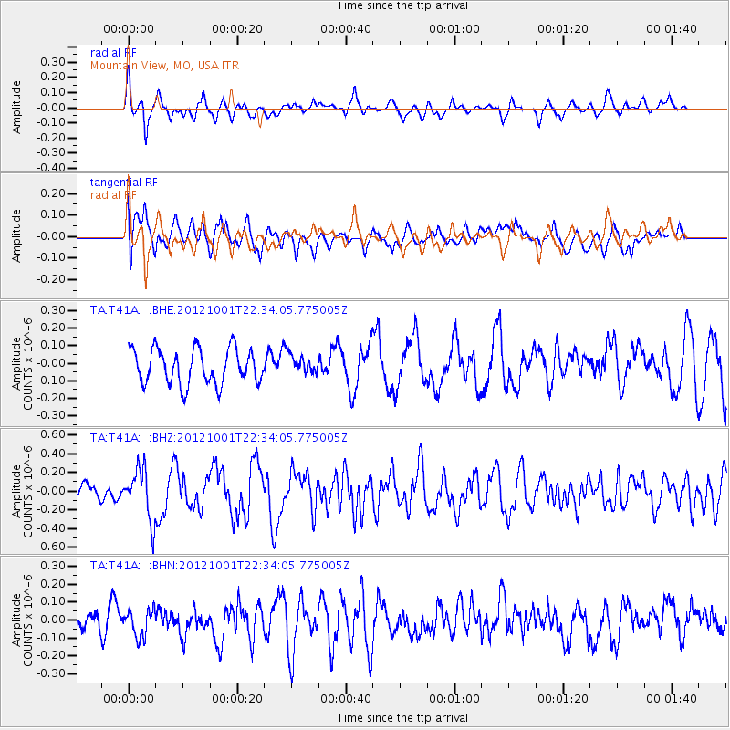
T41A Mountain View, MO, USA - Earthquake Result Viewer
*The percent match for this event was below the threshold and hence no stack was calculated.
| Earthquake location: |
Off East Coast Of Honshu, Japan |
| Earthquake latitude/longitude: |
39.8/143.1 |
| Earthquake time(UTC): |
2012/10/01 (275) 22:21:46 GMT |
| Earthquake Depth: |
15 km |
| Earthquake Magnitude: |
5.6 MB, 5.7 MS, 6.1 MW, 6.0 MW |
| Earthquake Catalog/Contributor: |
WHDF/NEIC |
|
| Network: |
TA USArray Transportable Network (new EarthScope stations) |
| Station: |
T41A Mountain View, MO, USA |
| Lat/Lon: |
37.04 N/91.76 W |
| Elevation: |
366 m |
|
| Distance: |
88.4 deg |
| Az: |
40.887 deg |
| Baz: |
320.937 deg |
| Ray Param: |
$rayparam |
*The percent match for this event was below the threshold and hence was not used in the summary stack. |
|
| Radial Match: |
59.232895 % |
| Radial Bump: |
400 |
| Transverse Match: |
64.855194 % |
| Transverse Bump: |
400 |
| SOD ConfigId: |
478790 |
| Insert Time: |
2013-02-23 01:35:43.700 +0000 |
| GWidth: |
2.5 |
| Max Bumps: |
400 |
| Tol: |
0.001 |
|
Signal To Noise
| Channel | StoN | STA | LTA |
| TA:T41A: :BHZ:20121001T22:34:05.775005Z | 2.0271816 | 2.7173132E-7 | 1.340439E-7 |
| TA:T41A: :BHN:20121001T22:34:05.775005Z | 0.6179542 | 7.390041E-8 | 1.1958882E-7 |
| TA:T41A: :BHE:20121001T22:34:05.775005Z | 0.5332343 | 5.2926264E-8 | 9.925518E-8 |
| Arrivals |
| Ps | |
| PpPs | |
| PsPs/PpSs | |


