You are here: Home > Network List > TA - USArray Transportable Network (new EarthScope stations) Stations List
> Station R41A Rosebud, MO, USA > Earthquake Result Viewer
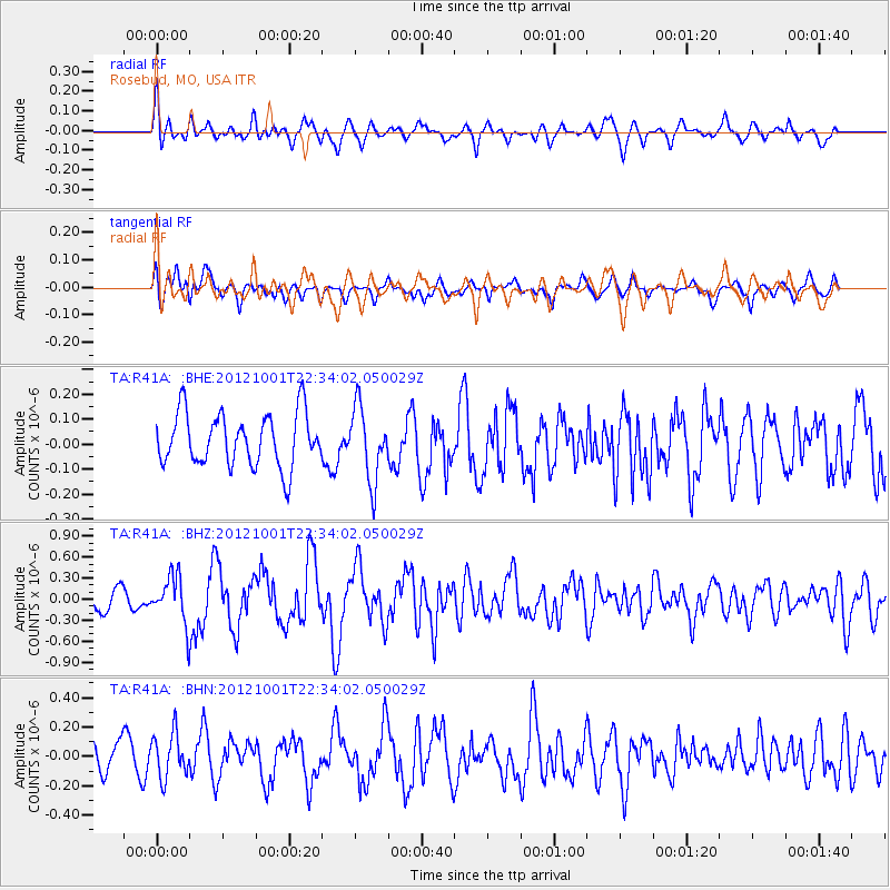
R41A Rosebud, MO, USA - Earthquake Result Viewer
*The percent match for this event was below the threshold and hence no stack was calculated.
| Earthquake location: |
Off East Coast Of Honshu, Japan |
| Earthquake latitude/longitude: |
39.8/143.1 |
| Earthquake time(UTC): |
2012/10/01 (275) 22:21:46 GMT |
| Earthquake Depth: |
15 km |
| Earthquake Magnitude: |
5.6 MB, 5.7 MS, 6.1 MW, 6.0 MW |
| Earthquake Catalog/Contributor: |
WHDF/NEIC |
|
| Network: |
TA USArray Transportable Network (new EarthScope stations) |
| Station: |
R41A Rosebud, MO, USA |
| Lat/Lon: |
38.30 N/91.38 W |
| Elevation: |
257 m |
|
| Distance: |
87.6 deg |
| Az: |
39.862 deg |
| Baz: |
321.135 deg |
| Ray Param: |
$rayparam |
*The percent match for this event was below the threshold and hence was not used in the summary stack. |
|
| Radial Match: |
51.534378 % |
| Radial Bump: |
400 |
| Transverse Match: |
52.979675 % |
| Transverse Bump: |
400 |
| SOD ConfigId: |
478790 |
| Insert Time: |
2013-02-23 01:36:33.929 +0000 |
| GWidth: |
2.5 |
| Max Bumps: |
400 |
| Tol: |
0.001 |
|
Signal To Noise
| Channel | StoN | STA | LTA |
| TA:R41A: :BHZ:20121001T22:34:02.050029Z | 2.838986 | 3.3818742E-7 | 1.1912261E-7 |
| TA:R41A: :BHN:20121001T22:34:02.050029Z | 1.5224423 | 1.4933799E-7 | 9.8091064E-8 |
| TA:R41A: :BHE:20121001T22:34:02.050029Z | 1.3884879 | 1.459542E-7 | 1.0511738E-7 |
| Arrivals |
| Ps | |
| PpPs | |
| PsPs/PpSs | |


