You are here: Home > Network List > TA - USArray Transportable Network (new EarthScope stations) Stations List
> Station T51A Gray, KY, USA > Earthquake Result Viewer
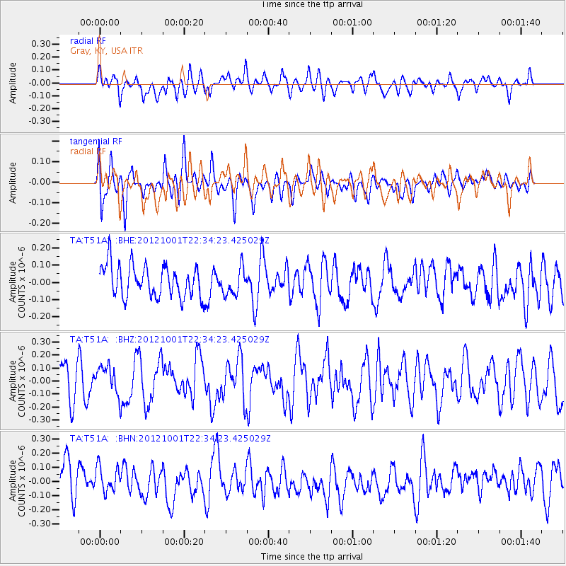
T51A Gray, KY, USA - Earthquake Result Viewer
*The percent match for this event was below the threshold and hence no stack was calculated.
| Earthquake location: |
Off East Coast Of Honshu, Japan |
| Earthquake latitude/longitude: |
39.8/143.1 |
| Earthquake time(UTC): |
2012/10/01 (275) 22:21:46 GMT |
| Earthquake Depth: |
15 km |
| Earthquake Magnitude: |
5.6 MB, 5.7 MS, 6.1 MW, 6.0 MW |
| Earthquake Catalog/Contributor: |
WHDF/NEIC |
|
| Network: |
TA USArray Transportable Network (new EarthScope stations) |
| Station: |
T51A Gray, KY, USA |
| Lat/Lon: |
36.97 N/83.95 W |
| Elevation: |
329 m |
|
| Distance: |
92.2 deg |
| Az: |
35.918 deg |
| Baz: |
325.654 deg |
| Ray Param: |
$rayparam |
*The percent match for this event was below the threshold and hence was not used in the summary stack. |
|
| Radial Match: |
49.193634 % |
| Radial Bump: |
400 |
| Transverse Match: |
44.47373 % |
| Transverse Bump: |
400 |
| SOD ConfigId: |
478790 |
| Insert Time: |
2013-02-23 01:39:10.292 +0000 |
| GWidth: |
2.5 |
| Max Bumps: |
400 |
| Tol: |
0.001 |
|
Signal To Noise
| Channel | StoN | STA | LTA |
| TA:T51A: :BHZ:20121001T22:34:23.425029Z | 0.85818964 | 1.1096951E-7 | 1.2930651E-7 |
| TA:T51A: :BHN:20121001T22:34:23.425029Z | 1.0161476 | 9.9604E-8 | 9.802119E-8 |
| TA:T51A: :BHE:20121001T22:34:23.425029Z | 0.85821974 | 7.919103E-8 | 9.227361E-8 |
| Arrivals |
| Ps | |
| PpPs | |
| PsPs/PpSs | |


