You are here: Home > Network List > TA - USArray Transportable Network (new EarthScope stations) Stations List
> Station Q48A North Vernon, IN, USA > Earthquake Result Viewer
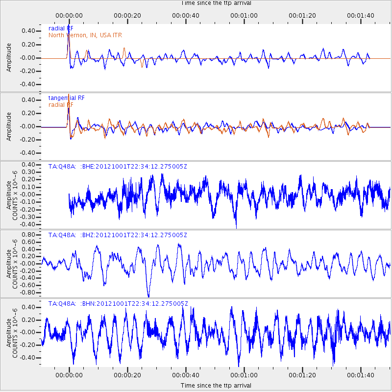
Q48A North Vernon, IN, USA - Earthquake Result Viewer
*The percent match for this event was below the threshold and hence no stack was calculated.
| Earthquake location: |
Off East Coast Of Honshu, Japan |
| Earthquake latitude/longitude: |
39.8/143.1 |
| Earthquake time(UTC): |
2012/10/01 (275) 22:21:46 GMT |
| Earthquake Depth: |
15 km |
| Earthquake Magnitude: |
5.6 MB, 5.7 MS, 6.1 MW, 6.0 MW |
| Earthquake Catalog/Contributor: |
WHDF/NEIC |
|
| Network: |
TA USArray Transportable Network (new EarthScope stations) |
| Station: |
Q48A North Vernon, IN, USA |
| Lat/Lon: |
38.93 N/85.73 W |
| Elevation: |
185 m |
|
| Distance: |
89.8 deg |
| Az: |
35.954 deg |
| Baz: |
324.559 deg |
| Ray Param: |
$rayparam |
*The percent match for this event was below the threshold and hence was not used in the summary stack. |
|
| Radial Match: |
57.392517 % |
| Radial Bump: |
400 |
| Transverse Match: |
54.88845 % |
| Transverse Bump: |
400 |
| SOD ConfigId: |
478790 |
| Insert Time: |
2013-02-23 01:39:21.856 +0000 |
| GWidth: |
2.5 |
| Max Bumps: |
400 |
| Tol: |
0.001 |
|
Signal To Noise
| Channel | StoN | STA | LTA |
| TA:Q48A: :BHZ:20121001T22:34:12.275005Z | 1.6680228 | 1.8825364E-7 | 1.12860356E-7 |
| TA:Q48A: :BHN:20121001T22:34:12.275005Z | 1.6531473 | 1.9904947E-7 | 1.2040637E-7 |
| TA:Q48A: :BHE:20121001T22:34:12.275005Z | 1.7910084 | 1.6452931E-7 | 9.1864074E-8 |
| Arrivals |
| Ps | |
| PpPs | |
| PsPs/PpSs | |


