
WMQ Urumqi, Xinjiang Province, China - Earthquake Result Viewer
| ||||||||||||||||||
| ||||||||||||||||||
| ||||||||||||||||||
|
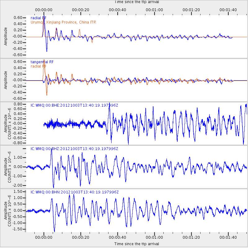
Signal To Noise
| Channel | StoN | STA | LTA |
| IC:WMQ:00:BHZ:20121003T13:40:19.197996Z | 8.383491 | 6.534428E-7 | 7.7944E-8 |
| IC:WMQ:00:BHN:20121003T13:40:19.197996Z | 5.904268 | 3.6520208E-7 | 6.185392E-8 |
| IC:WMQ:00:BHE:20121003T13:40:19.197996Z | 1.7674068 | 1.3221094E-7 | 7.4805044E-8 |
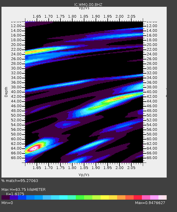
| Arrivals | |
| Ps | 7.0 SECOND |
| PpPs | 25 SECOND |
| PsPs/PpSs | 32 SECOND |

