You are here: Home > Network List > AZ - ANZA Regional Network Stations List
> Station SMER AZ.SMER > Earthquake Result Viewer
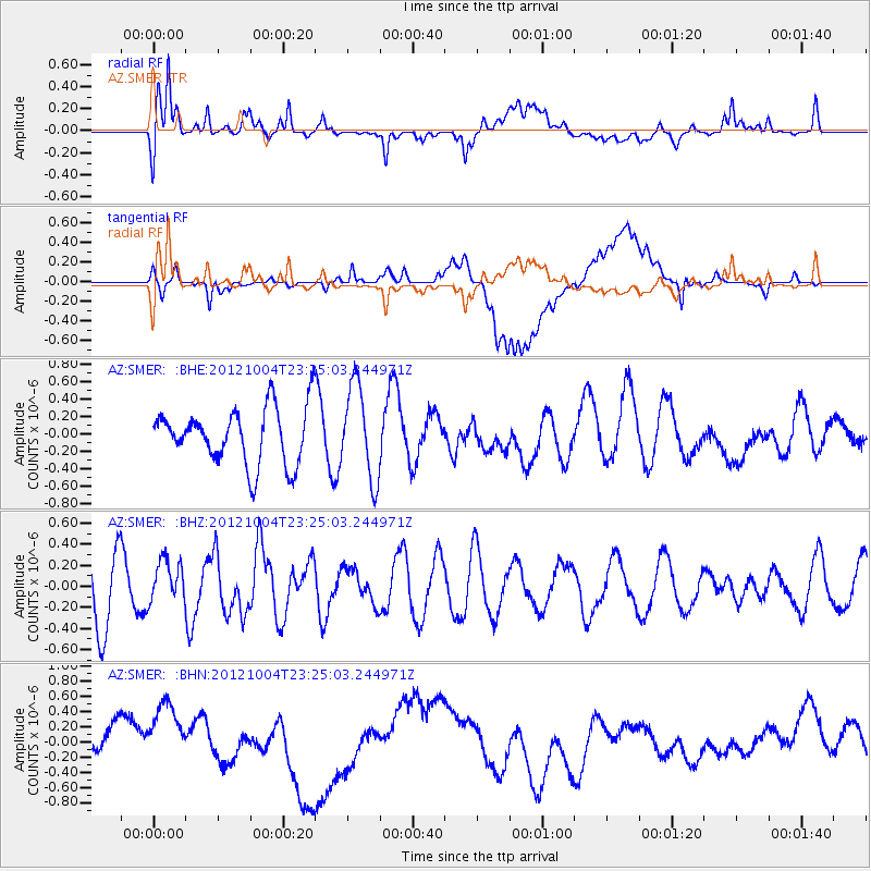
SMER AZ.SMER - Earthquake Result Viewer
*The percent match for this event was below the threshold and hence no stack was calculated.
| Earthquake location: |
Northern Mid-Atlantic Ridge |
| Earthquake latitude/longitude: |
17.4/-46.5 |
| Earthquake time(UTC): |
2012/10/04 (278) 23:14:56 GMT |
| Earthquake Depth: |
10 km |
| Earthquake Magnitude: |
5.5 MW, 5.0 MS, 5.4 MW, 5.3 MB |
| Earthquake Catalog/Contributor: |
WHDF/NEIC |
|
| Network: |
AZ ANZA Regional Network |
| Station: |
SMER AZ.SMER |
| Lat/Lon: |
33.46 N/117.17 W |
| Elevation: |
355 m |
|
| Distance: |
64.7 deg |
| Az: |
299.228 deg |
| Baz: |
85.196 deg |
| Ray Param: |
$rayparam |
*The percent match for this event was below the threshold and hence was not used in the summary stack. |
|
| Radial Match: |
69.04832 % |
| Radial Bump: |
400 |
| Transverse Match: |
35.658867 % |
| Transverse Bump: |
400 |
| SOD ConfigId: |
478790 |
| Insert Time: |
2013-02-23 01:46:12.038 +0000 |
| GWidth: |
2.5 |
| Max Bumps: |
400 |
| Tol: |
0.001 |
|
Signal To Noise
| Channel | StoN | STA | LTA |
| AZ:SMER: :BHZ:20121004T23:25:03.244971Z | 0.57046187 | 1.9671755E-7 | 3.448391E-7 |
| AZ:SMER: :BHN:20121004T23:25:03.244971Z | 1.2865754 | 3.7610585E-7 | 2.9233098E-7 |
| AZ:SMER: :BHE:20121004T23:25:03.244971Z | 1.6541991 | 5.322791E-7 | 3.217745E-7 |
| Arrivals |
| Ps | |
| PpPs | |
| PsPs/PpSs | |


