You are here: Home > Network List > CI - Caltech Regional Seismic Network Stations List
> Station DGR Domenigoni Reservoir, California, USA > Earthquake Result Viewer
DGR Domenigoni Reservoir, California, USA - Earthquake Result Viewer
*The percent match for this event was below the threshold and hence no stack was calculated.
| Earthquake location: |
Northern Mid-Atlantic Ridge |
| Earthquake latitude/longitude: |
17.4/-46.5 |
| Earthquake time(UTC): |
2012/10/04 (278) 23:14:56 GMT |
| Earthquake Depth: |
10 km |
| Earthquake Magnitude: |
5.5 MW, 5.0 MS, 5.4 MW, 5.3 MB |
| Earthquake Catalog/Contributor: |
WHDF/NEIC |
|
| Network: |
CI Caltech Regional Seismic Network |
| Station: |
DGR Domenigoni Reservoir, California, USA |
| Lat/Lon: |
33.65 N/117.01 W |
| Elevation: |
609 m |
|
| Distance: |
64.5 deg |
| Az: |
299.427 deg |
| Baz: |
85.371 deg |
| Ray Param: |
$rayparam |
*The percent match for this event was below the threshold and hence was not used in the summary stack. |
|
| Radial Match: |
66.14562 % |
| Radial Bump: |
400 |
| Transverse Match: |
57.73996 % |
| Transverse Bump: |
400 |
| SOD ConfigId: |
478790 |
| Insert Time: |
2013-02-23 01:47:09.346 +0000 |
| GWidth: |
2.5 |
| Max Bumps: |
400 |
| Tol: |
0.001 |
|
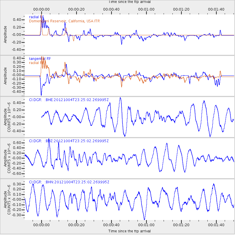
Signal To Noise
| Channel | StoN | STA | LTA |
| CI:DGR: :BHZ:20121004T23:25:02.269995Z | 1.9011595 | 3.254069E-7 | 1.7116233E-7 |
| CI:DGR: :BHN:20121004T23:25:02.269995Z | 0.897744 | 1.7471446E-7 | 1.9461501E-7 |
| CI:DGR: :BHE:20121004T23:25:02.269995Z | 1.849166 | 1.8192878E-7 | 9.838423E-8 |
| Arrivals |
| Ps | |
| PpPs | |
| PsPs/PpSs | |


