You are here: Home > Network List > TA - USArray Transportable Network (new EarthScope stations) Stations List
> Station 146A Union, MS, USA > Earthquake Result Viewer
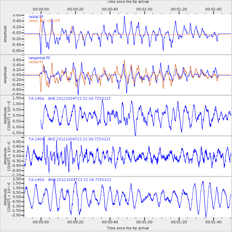
146A Union, MS, USA - Earthquake Result Viewer
*The percent match for this event was below the threshold and hence no stack was calculated.
| Earthquake location: |
Northern Mid-Atlantic Ridge |
| Earthquake latitude/longitude: |
17.4/-46.5 |
| Earthquake time(UTC): |
2012/10/04 (278) 23:14:56 GMT |
| Earthquake Depth: |
10 km |
| Earthquake Magnitude: |
5.5 MW, 5.0 MS, 5.4 MW, 5.3 MB |
| Earthquake Catalog/Contributor: |
WHDF/NEIC |
|
| Network: |
TA USArray Transportable Network (new EarthScope stations) |
| Station: |
146A Union, MS, USA |
| Lat/Lon: |
32.64 N/89.06 W |
| Elevation: |
164 m |
|
| Distance: |
41.1 deg |
| Az: |
299.829 deg |
| Baz: |
101.045 deg |
| Ray Param: |
$rayparam |
*The percent match for this event was below the threshold and hence was not used in the summary stack. |
|
| Radial Match: |
43.335564 % |
| Radial Bump: |
334 |
| Transverse Match: |
43.87428 % |
| Transverse Bump: |
299 |
| SOD ConfigId: |
478790 |
| Insert Time: |
2013-02-23 01:52:49.018 +0000 |
| GWidth: |
2.5 |
| Max Bumps: |
400 |
| Tol: |
0.001 |
|
Signal To Noise
| Channel | StoN | STA | LTA |
| TA:146A: :BHZ:20121004T23:22:09.725012Z | 1.9468915 | 4.917167E-7 | 2.5256503E-7 |
| TA:146A: :BHN:20121004T23:22:09.725012Z | 0.7491236 | 6.194777E-7 | 8.2693657E-7 |
| TA:146A: :BHE:20121004T23:22:09.725012Z | 0.61229694 | 3.5801304E-7 | 5.847049E-7 |
| Arrivals |
| Ps | |
| PpPs | |
| PsPs/PpSs | |


