You are here: Home > Network List > TA - USArray Transportable Network (new EarthScope stations) Stations List
> Station J40A Soldiers Grove, WI, USA > Earthquake Result Viewer
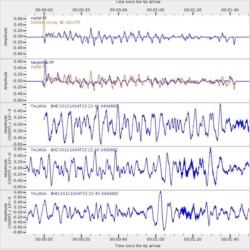
J40A Soldiers Grove, WI, USA - Earthquake Result Viewer
*The percent match for this event was below the threshold and hence no stack was calculated.
| Earthquake location: |
Northern Mid-Atlantic Ridge |
| Earthquake latitude/longitude: |
17.4/-46.5 |
| Earthquake time(UTC): |
2012/10/04 (278) 23:14:56 GMT |
| Earthquake Depth: |
10 km |
| Earthquake Magnitude: |
5.5 MW, 5.0 MS, 5.4 MW, 5.3 MB |
| Earthquake Catalog/Contributor: |
WHDF/NEIC |
|
| Network: |
TA USArray Transportable Network (new EarthScope stations) |
| Station: |
J40A Soldiers Grove, WI, USA |
| Lat/Lon: |
43.40 N/90.74 W |
| Elevation: |
353 m |
|
| Distance: |
45.4 deg |
| Az: |
314.395 deg |
| Baz: |
110.65 deg |
| Ray Param: |
$rayparam |
*The percent match for this event was below the threshold and hence was not used in the summary stack. |
|
| Radial Match: |
37.753506 % |
| Radial Bump: |
332 |
| Transverse Match: |
63.107502 % |
| Transverse Bump: |
400 |
| SOD ConfigId: |
478790 |
| Insert Time: |
2013-02-23 01:54:35.612 +0000 |
| GWidth: |
2.5 |
| Max Bumps: |
400 |
| Tol: |
0.001 |
|
Signal To Noise
| Channel | StoN | STA | LTA |
| TA:J40A: :BHZ:20121004T23:22:43.949988Z | 1.2725929 | 2.761339E-7 | 2.1698526E-7 |
| TA:J40A: :BHN:20121004T23:22:43.949988Z | 1.2758731 | 2.5400914E-7 | 1.9908651E-7 |
| TA:J40A: :BHE:20121004T23:22:43.949988Z | 1.2516614 | 3.0300333E-7 | 2.420809E-7 |
| Arrivals |
| Ps | |
| PpPs | |
| PsPs/PpSs | |


