You are here: Home > Network List > TA - USArray Transportable Network (new EarthScope stations) Stations List
> Station U41A Viola, AR, USA > Earthquake Result Viewer
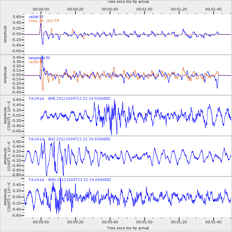
U41A Viola, AR, USA - Earthquake Result Viewer
*The percent match for this event was below the threshold and hence no stack was calculated.
| Earthquake location: |
Northern Mid-Atlantic Ridge |
| Earthquake latitude/longitude: |
17.4/-46.5 |
| Earthquake time(UTC): |
2012/10/04 (278) 23:14:56 GMT |
| Earthquake Depth: |
10 km |
| Earthquake Magnitude: |
5.5 MW, 5.0 MS, 5.4 MW, 5.3 MB |
| Earthquake Catalog/Contributor: |
WHDF/NEIC |
|
| Network: |
TA USArray Transportable Network (new EarthScope stations) |
| Station: |
U41A Viola, AR, USA |
| Lat/Lon: |
36.34 N/91.92 W |
| Elevation: |
300 m |
|
| Distance: |
44.2 deg |
| Az: |
304.444 deg |
| Baz: |
102.825 deg |
| Ray Param: |
$rayparam |
*The percent match for this event was below the threshold and hence was not used in the summary stack. |
|
| Radial Match: |
62.837257 % |
| Radial Bump: |
400 |
| Transverse Match: |
76.15049 % |
| Transverse Bump: |
400 |
| SOD ConfigId: |
478790 |
| Insert Time: |
2013-02-23 01:54:46.964 +0000 |
| GWidth: |
2.5 |
| Max Bumps: |
400 |
| Tol: |
0.001 |
|
Signal To Noise
| Channel | StoN | STA | LTA |
| TA:U41A: :BHZ:20121004T23:22:34.699988Z | 3.1645694 | 4.1055065E-7 | 1.2973351E-7 |
| TA:U41A: :BHN:20121004T23:22:34.699988Z | 1.6586995 | 1.8338955E-7 | 1.1056225E-7 |
| TA:U41A: :BHE:20121004T23:22:34.699988Z | 2.5333784 | 2.2420635E-7 | 8.850093E-8 |
| Arrivals |
| Ps | |
| PpPs | |
| PsPs/PpSs | |


