You are here: Home > Network List > TA - USArray Transportable Network (new EarthScope stations) Stations List
> Station 356A Blackshear, GA, USA > Earthquake Result Viewer
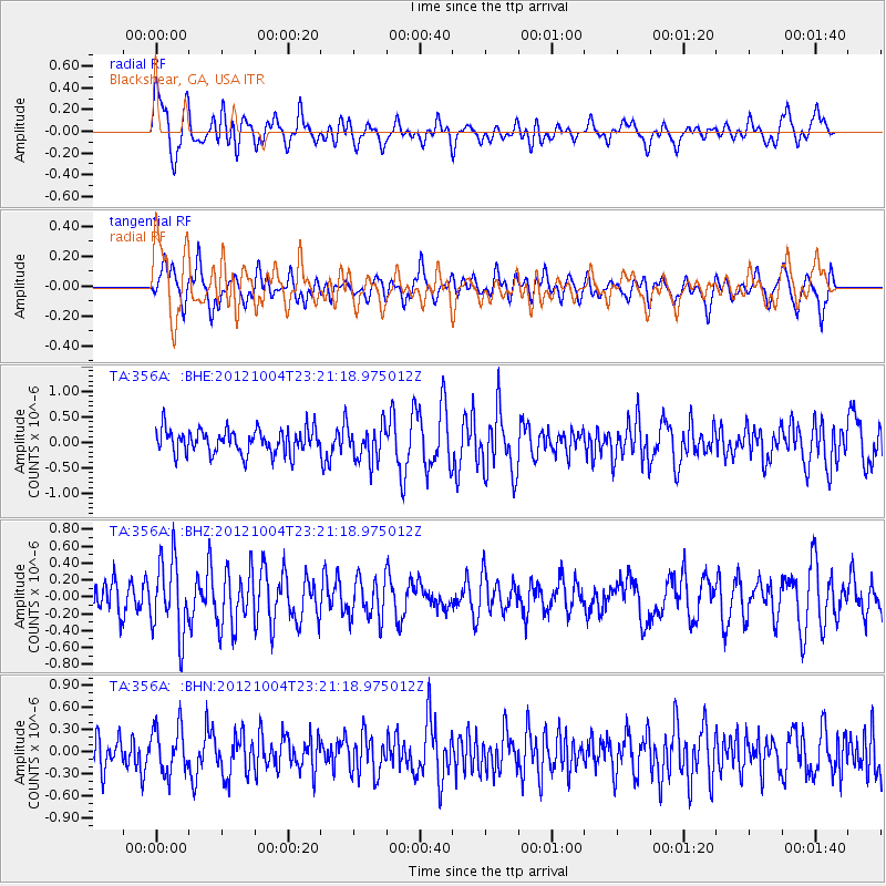
356A Blackshear, GA, USA - Earthquake Result Viewer
*The percent match for this event was below the threshold and hence no stack was calculated.
| Earthquake location: |
Northern Mid-Atlantic Ridge |
| Earthquake latitude/longitude: |
17.4/-46.5 |
| Earthquake time(UTC): |
2012/10/04 (278) 23:14:56 GMT |
| Earthquake Depth: |
10 km |
| Earthquake Magnitude: |
5.5 MW, 5.0 MS, 5.4 MW, 5.3 MB |
| Earthquake Catalog/Contributor: |
WHDF/NEIC |
|
| Network: |
TA USArray Transportable Network (new EarthScope stations) |
| Station: |
356A Blackshear, GA, USA |
| Lat/Lon: |
31.32 N/82.13 W |
| Elevation: |
36 m |
|
| Distance: |
35.1 deg |
| Az: |
299.896 deg |
| Baz: |
104.753 deg |
| Ray Param: |
$rayparam |
*The percent match for this event was below the threshold and hence was not used in the summary stack. |
|
| Radial Match: |
51.101414 % |
| Radial Bump: |
400 |
| Transverse Match: |
55.439114 % |
| Transverse Bump: |
400 |
| SOD ConfigId: |
478790 |
| Insert Time: |
2013-02-23 01:57:51.184 +0000 |
| GWidth: |
2.5 |
| Max Bumps: |
400 |
| Tol: |
0.001 |
|
Signal To Noise
| Channel | StoN | STA | LTA |
| TA:356A: :BHZ:20121004T23:21:18.975012Z | 2.4369297 | 4.3639102E-7 | 1.790741E-7 |
| TA:356A: :BHN:20121004T23:21:18.975012Z | 1.0512906 | 3.0847175E-7 | 2.9342198E-7 |
| TA:356A: :BHE:20121004T23:21:18.975012Z | 1.4309578 | 3.4224465E-7 | 2.3917173E-7 |
| Arrivals |
| Ps | |
| PpPs | |
| PsPs/PpSs | |


