You are here: Home > Network List > IU - Global Seismograph Network (GSN - IRIS/USGS) Stations List
> Station XMAS Kiritimati Island, Republic of Kiribati > Earthquake Result Viewer
XMAS Kiritimati Island, Republic of Kiribati - Earthquake Result Viewer
*The percent match for this event was below the threshold and hence no stack was calculated.
| Earthquake location: |
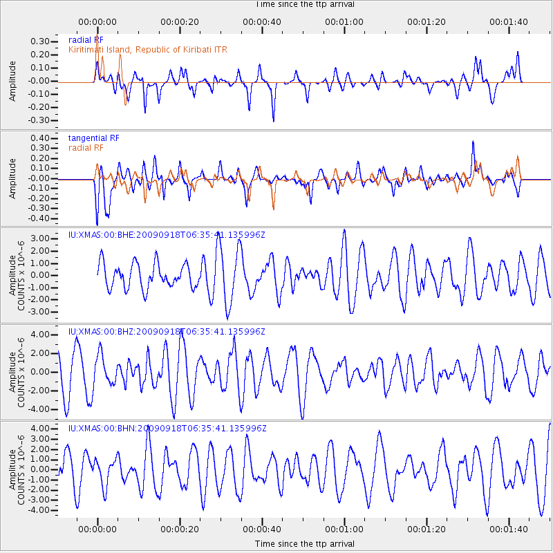
Mindoro, Philippines |
| Earthquake latitude/longitude: |
12.6/120.4 |
| Earthquake time(UTC): |
2009/09/18 (261) 06:23:53 GMT |
| Earthquake Depth: |
12 km |
| Earthquake Magnitude: |
6.0 MB, 5.7 MS, 6.0 MW, 5.9 MW |
| Earthquake Catalog/Contributor: |
WHDF/NEIC |
|
| Network: |
IU Global Seismograph Network (GSN - IRIS/USGS) |
| Station: |
XMAS Kiritimati Island, Republic of Kiribati |
| Lat/Lon: |
2.04 N/157.45 W |
| Elevation: |
20 m |
|
| Distance: |
81.9 deg |
| Az: |
89.717 deg |
| Baz: |
282.374 deg |
| Ray Param: |
$rayparam |
*The percent match for this event was below the threshold and hence was not used in the summary stack. |
|
| Radial Match: |
48.39504 % |
| Radial Bump: |
400 |
| Transverse Match: |
59.782375 % |
| Transverse Bump: |
400 |
| SOD ConfigId: |
1 |
| Insert Time: |
2010-02-19 00:14:28.060 +0000 |
| GWidth: |
2.5 |
| Max Bumps: |
400 |
| Tol: |
0.001 |
|
Signal To Noise
| Channel | StoN | STA | LTA |
| IU:XMAS:00:BHZ:20090918T06:35:41.135996Z | 1.0552138 | 1.5402087E-6 | 1.4596177E-6 |
| IU:XMAS:00:BHN:20090918T06:35:41.135996Z | 0.88852084 | 1.3461517E-6 | 1.5150481E-6 |
| IU:XMAS:00:BHE:20090918T06:35:41.135996Z | 2.5304306 | 2.4788164E-6 | 9.796026E-7 |
| Arrivals |
| Ps | |
| PpPs | |
| PsPs/PpSs | |


