You are here: Home > Network List > TA - USArray Transportable Network (new EarthScope stations) Stations List
> Station W50A Signal Mountain, TN, USA > Earthquake Result Viewer
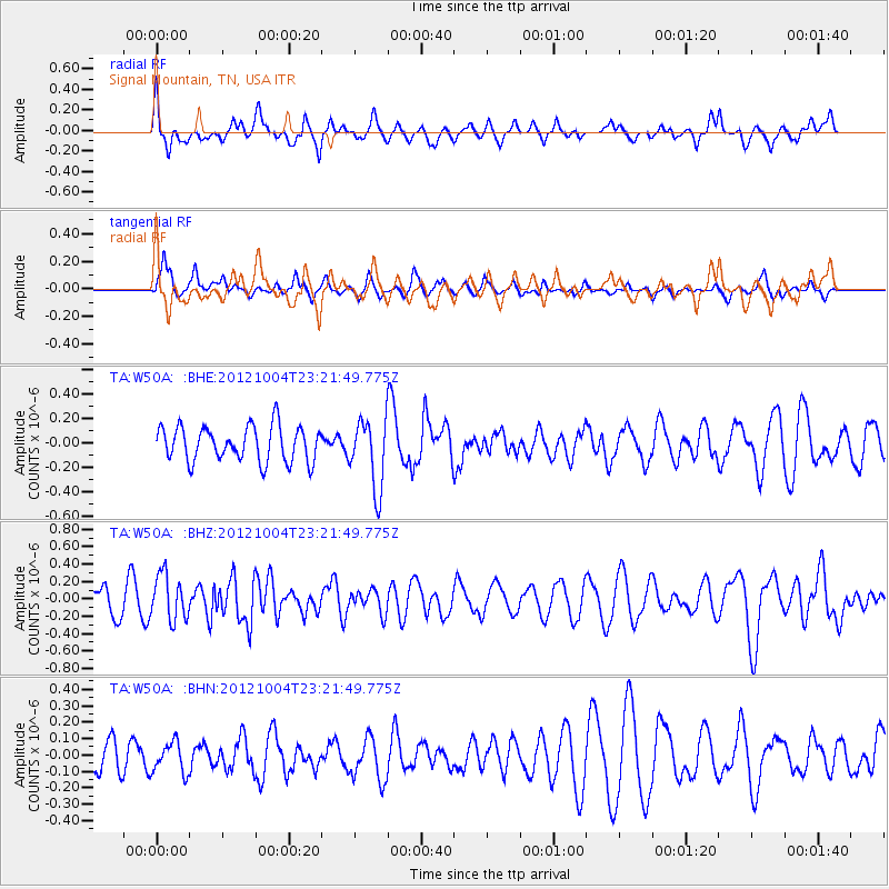
W50A Signal Mountain, TN, USA - Earthquake Result Viewer
*The percent match for this event was below the threshold and hence no stack was calculated.
| Earthquake location: |
Northern Mid-Atlantic Ridge |
| Earthquake latitude/longitude: |
17.4/-46.5 |
| Earthquake time(UTC): |
2012/10/04 (278) 23:14:56 GMT |
| Earthquake Depth: |
10 km |
| Earthquake Magnitude: |
5.5 MW, 5.0 MS, 5.4 MW, 5.3 MB |
| Earthquake Catalog/Contributor: |
WHDF/NEIC |
|
| Network: |
TA USArray Transportable Network (new EarthScope stations) |
| Station: |
W50A Signal Mountain, TN, USA |
| Lat/Lon: |
35.20 N/85.31 W |
| Elevation: |
587 m |
|
| Distance: |
38.7 deg |
| Az: |
304.868 deg |
| Baz: |
106.992 deg |
| Ray Param: |
$rayparam |
*The percent match for this event was below the threshold and hence was not used in the summary stack. |
|
| Radial Match: |
60.603233 % |
| Radial Bump: |
400 |
| Transverse Match: |
60.920856 % |
| Transverse Bump: |
380 |
| SOD ConfigId: |
478790 |
| Insert Time: |
2013-02-23 01:58:16.847 +0000 |
| GWidth: |
2.5 |
| Max Bumps: |
400 |
| Tol: |
0.001 |
|
Signal To Noise
| Channel | StoN | STA | LTA |
| TA:W50A: :BHZ:20121004T23:21:49.775Z | 1.3918393 | 2.582674E-7 | 1.8555833E-7 |
| TA:W50A: :BHN:20121004T23:21:49.775Z | 0.771533 | 9.36303E-8 | 1.2135618E-7 |
| TA:W50A: :BHE:20121004T23:21:49.775Z | 1.9948901 | 2.8311965E-7 | 1.4192243E-7 |
| Arrivals |
| Ps | |
| PpPs | |
| PsPs/PpSs | |


