You are here: Home > Network List > UW - Pacific Northwest Regional Seismic Network Stations List
> Station LEBA Lebam, WA, USA > Earthquake Result Viewer
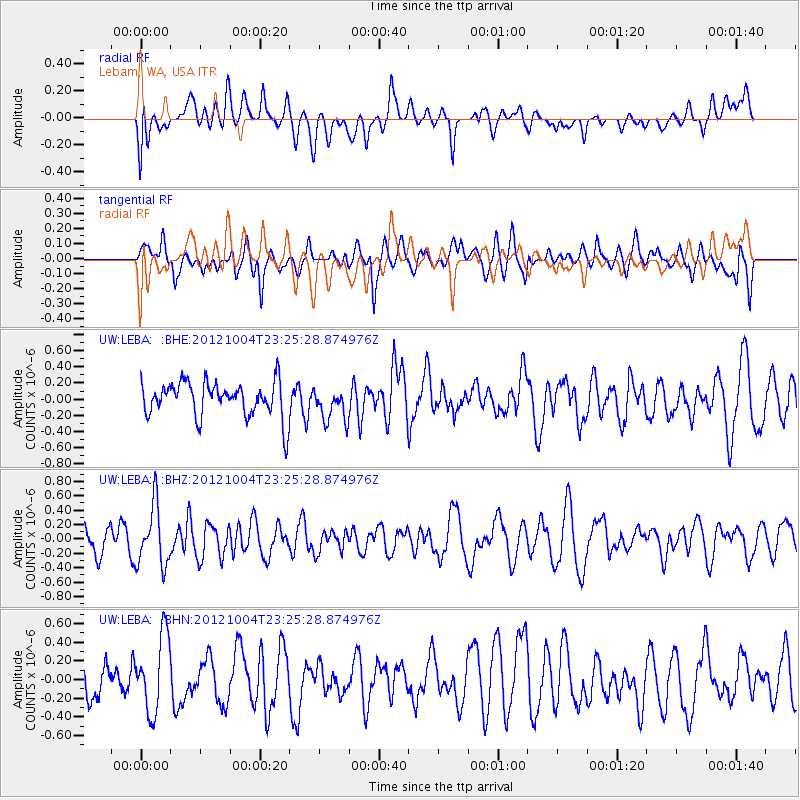
LEBA Lebam, WA, USA - Earthquake Result Viewer
*The percent match for this event was below the threshold and hence no stack was calculated.
| Earthquake location: |
Northern Mid-Atlantic Ridge |
| Earthquake latitude/longitude: |
17.4/-46.5 |
| Earthquake time(UTC): |
2012/10/04 (278) 23:14:56 GMT |
| Earthquake Depth: |
10 km |
| Earthquake Magnitude: |
5.5 MW, 5.0 MS, 5.4 MW, 5.3 MB |
| Earthquake Catalog/Contributor: |
WHDF/NEIC |
|
| Network: |
UW Pacific Northwest Regional Seismic Network |
| Station: |
LEBA Lebam, WA, USA |
| Lat/Lon: |
46.55 N/123.56 W |
| Elevation: |
73 m |
|
| Distance: |
68.7 deg |
| Az: |
313.784 deg |
| Baz: |
86.862 deg |
| Ray Param: |
$rayparam |
*The percent match for this event was below the threshold and hence was not used in the summary stack. |
|
| Radial Match: |
42.845596 % |
| Radial Bump: |
400 |
| Transverse Match: |
45.888245 % |
| Transverse Bump: |
400 |
| SOD ConfigId: |
478790 |
| Insert Time: |
2013-02-23 01:59:15.634 +0000 |
| GWidth: |
2.5 |
| Max Bumps: |
400 |
| Tol: |
0.001 |
|
Signal To Noise
| Channel | StoN | STA | LTA |
| UW:LEBA: :BHZ:20121004T23:25:28.874976Z | 1.8608187 | 4.1576732E-7 | 2.2343245E-7 |
| UW:LEBA: :BHN:20121004T23:25:28.874976Z | 1.5639663 | 4.120401E-7 | 2.6345845E-7 |
| UW:LEBA: :BHE:20121004T23:25:28.874976Z | 0.9580913 | 2.0810265E-7 | 2.1720545E-7 |
| Arrivals |
| Ps | |
| PpPs | |
| PsPs/PpSs | |


