You are here: Home > Network List > TA - USArray Transportable Network (new EarthScope stations) Stations List
> Station 147A Livingston, AL, USA > Earthquake Result Viewer
147A Livingston, AL, USA - Earthquake Result Viewer
*The percent match for this event was below the threshold and hence no stack was calculated.
| Earthquake location: |
Northern Mid-Atlantic Ridge |
| Earthquake latitude/longitude: |
17.5/-46.5 |
| Earthquake time(UTC): |
2012/10/05 (279) 00:19:56 GMT |
| Earthquake Depth: |
10 km |
| Earthquake Magnitude: |
5.7 MW, 5.3 MS, 5.2 MB, 5.5 MW |
| Earthquake Catalog/Contributor: |
WHDF/NEIC |
|
| Network: |
TA USArray Transportable Network (new EarthScope stations) |
| Station: |
147A Livingston, AL, USA |
| Lat/Lon: |
32.67 N/88.27 W |
| Elevation: |
57 m |
|
| Distance: |
40.5 deg |
| Az: |
300.037 deg |
| Baz: |
101.582 deg |
| Ray Param: |
$rayparam |
*The percent match for this event was below the threshold and hence was not used in the summary stack. |
|
| Radial Match: |
43.25413 % |
| Radial Bump: |
232 |
| Transverse Match: |
51.609394 % |
| Transverse Bump: |
324 |
| SOD ConfigId: |
478790 |
| Insert Time: |
2013-02-23 02:08:24.155 +0000 |
| GWidth: |
2.5 |
| Max Bumps: |
400 |
| Tol: |
0.001 |
|
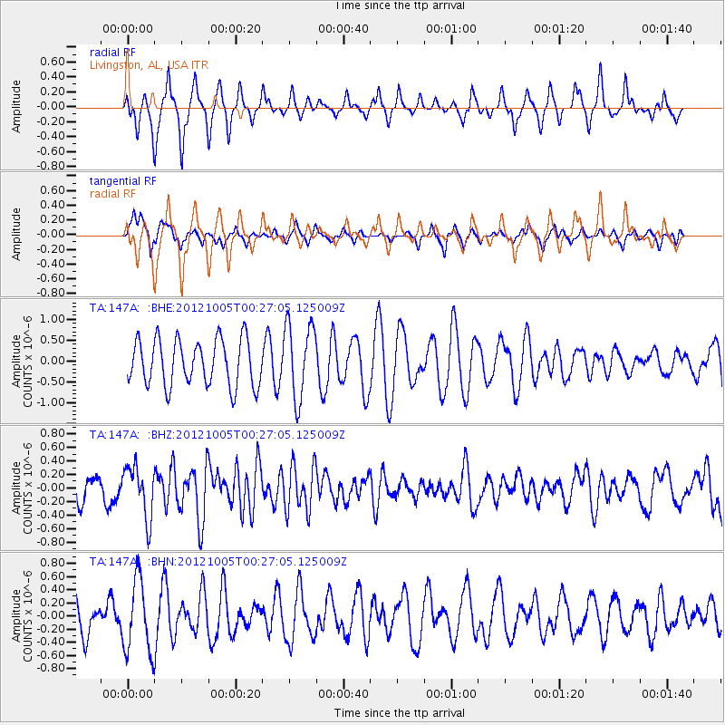
Signal To Noise
| Channel | StoN | STA | LTA |
| TA:147A: :BHZ:20121005T00:27:05.125009Z | 2.2296405 | 3.8438694E-7 | 1.7239861E-7 |
| TA:147A: :BHN:20121005T00:27:05.125009Z | 1.5673057 | 5.6365263E-7 | 3.596316E-7 |
| TA:147A: :BHE:20121005T00:27:05.125009Z | 1.6576861 | 9.171732E-7 | 5.532852E-7 |
| Arrivals |
| Ps | |
| PpPs | |
| PsPs/PpSs | |


