You are here: Home > Network List > TA - USArray Transportable Network (new EarthScope stations) Stations List
> Station L41A Preston, IA, USA > Earthquake Result Viewer
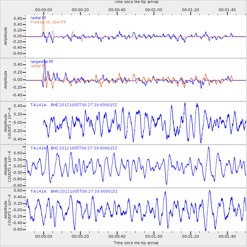
L41A Preston, IA, USA - Earthquake Result Viewer
*The percent match for this event was below the threshold and hence no stack was calculated.
| Earthquake location: |
Northern Mid-Atlantic Ridge |
| Earthquake latitude/longitude: |
17.5/-46.5 |
| Earthquake time(UTC): |
2012/10/05 (279) 00:19:56 GMT |
| Earthquake Depth: |
10 km |
| Earthquake Magnitude: |
5.7 MW, 5.3 MS, 5.2 MB, 5.5 MW |
| Earthquake Catalog/Contributor: |
WHDF/NEIC |
|
| Network: |
TA USArray Transportable Network (new EarthScope stations) |
| Station: |
L41A Preston, IA, USA |
| Lat/Lon: |
42.08 N/90.50 W |
| Elevation: |
238 m |
|
| Distance: |
44.8 deg |
| Az: |
312.69 deg |
| Baz: |
109.564 deg |
| Ray Param: |
$rayparam |
*The percent match for this event was below the threshold and hence was not used in the summary stack. |
|
| Radial Match: |
63.51315 % |
| Radial Bump: |
400 |
| Transverse Match: |
75.04407 % |
| Transverse Bump: |
400 |
| SOD ConfigId: |
478790 |
| Insert Time: |
2013-02-23 02:09:10.527 +0000 |
| GWidth: |
2.5 |
| Max Bumps: |
400 |
| Tol: |
0.001 |
|
Signal To Noise
| Channel | StoN | STA | LTA |
| TA:L41A: :BHZ:20121005T00:27:39.600015Z | 2.1183808 | 5.202672E-7 | 2.4559662E-7 |
| TA:L41A: :BHN:20121005T00:27:39.600015Z | 1.0556964 | 2.45823E-7 | 2.3285386E-7 |
| TA:L41A: :BHE:20121005T00:27:39.600015Z | 1.3447608 | 1.8522145E-7 | 1.3773561E-7 |
| Arrivals |
| Ps | |
| PpPs | |
| PsPs/PpSs | |


