You are here: Home > Network List > TA - USArray Transportable Network (new EarthScope stations) Stations List
> Station 249A Camden, AL, USA > Earthquake Result Viewer
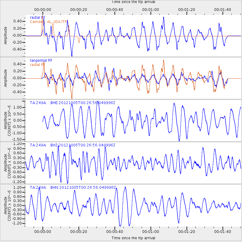
249A Camden, AL, USA - Earthquake Result Viewer
*The percent match for this event was below the threshold and hence no stack was calculated.
| Earthquake location: |
Northern Mid-Atlantic Ridge |
| Earthquake latitude/longitude: |
17.5/-46.5 |
| Earthquake time(UTC): |
2012/10/05 (279) 00:19:56 GMT |
| Earthquake Depth: |
10 km |
| Earthquake Magnitude: |
5.7 MW, 5.3 MS, 5.2 MB, 5.5 MW |
| Earthquake Catalog/Contributor: |
WHDF/NEIC |
|
| Network: |
TA USArray Transportable Network (new EarthScope stations) |
| Station: |
249A Camden, AL, USA |
| Lat/Lon: |
31.98 N/87.12 W |
| Elevation: |
66 m |
|
| Distance: |
39.4 deg |
| Az: |
299.279 deg |
| Baz: |
101.612 deg |
| Ray Param: |
$rayparam |
*The percent match for this event was below the threshold and hence was not used in the summary stack. |
|
| Radial Match: |
47.133953 % |
| Radial Bump: |
385 |
| Transverse Match: |
53.555233 % |
| Transverse Bump: |
373 |
| SOD ConfigId: |
478790 |
| Insert Time: |
2013-02-23 02:11:08.385 +0000 |
| GWidth: |
2.5 |
| Max Bumps: |
400 |
| Tol: |
0.001 |
|
Signal To Noise
| Channel | StoN | STA | LTA |
| TA:249A: :BHZ:20121005T00:26:56.049996Z | 2.0408068 | 4.4590837E-7 | 2.1849611E-7 |
| TA:249A: :BHN:20121005T00:26:56.049996Z | 1.4545891 | 5.532424E-7 | 3.8034273E-7 |
| TA:249A: :BHE:20121005T00:26:56.049996Z | 1.3915071 | 9.507819E-7 | 6.832749E-7 |
| Arrivals |
| Ps | |
| PpPs | |
| PsPs/PpSs | |


