You are here: Home > Network List > CN - Canadian National Seismograph Network Stations List
> Station INK INUVIK, NT > Earthquake Result Viewer
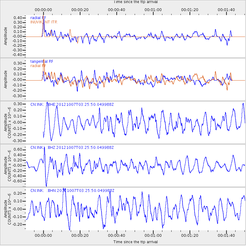
INK INUVIK, NT - Earthquake Result Viewer
*The percent match for this event was below the threshold and hence no stack was calculated.
| Earthquake location: |
Luzon, Philippines |
| Earthquake latitude/longitude: |
18.5/120.9 |
| Earthquake time(UTC): |
2012/10/07 (281) 03:14:24 GMT |
| Earthquake Depth: |
40 km |
| Earthquake Magnitude: |
5.5 MB, 5.0 MS, 5.6 MW, 5.5 MW |
| Earthquake Catalog/Contributor: |
WHDF/NEIC |
|
| Network: |
CN Canadian National Seismograph Network |
| Station: |
INK INUVIK, NT |
| Lat/Lon: |
68.31 N/133.53 W |
| Elevation: |
44 m |
|
| Distance: |
78.5 deg |
| Az: |
21.439 deg |
| Baz: |
291.138 deg |
| Ray Param: |
$rayparam |
*The percent match for this event was below the threshold and hence was not used in the summary stack. |
|
| Radial Match: |
60.3847 % |
| Radial Bump: |
400 |
| Transverse Match: |
59.924652 % |
| Transverse Bump: |
400 |
| SOD ConfigId: |
478790 |
| Insert Time: |
2013-02-23 02:18:28.329 +0000 |
| GWidth: |
2.5 |
| Max Bumps: |
400 |
| Tol: |
0.001 |
|
Signal To Noise
| Channel | StoN | STA | LTA |
| CN:INK: :BHZ:20121007T03:25:50.049988Z | 4.1756425 | 3.8513144E-7 | 9.223286E-8 |
| CN:INK: :BHN:20121007T03:25:50.049988Z | 1.0343572 | 9.340896E-8 | 9.030629E-8 |
| CN:INK: :BHE:20121007T03:25:50.049988Z | 0.76868606 | 1.0483562E-7 | 1.3638288E-7 |
| Arrivals |
| Ps | |
| PpPs | |
| PsPs/PpSs | |


