You are here: Home > Network List > CI - Caltech Regional Seismic Network Stations List
> Station FUR Furnace Creek, CA, USA > Earthquake Result Viewer
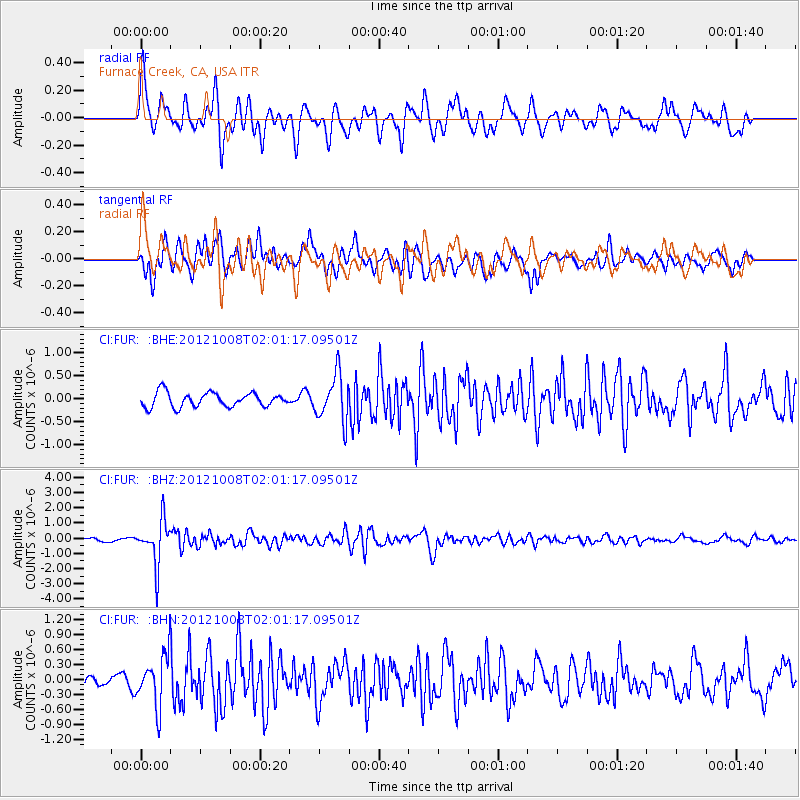
FUR Furnace Creek, CA, USA - Earthquake Result Viewer
*The percent match for this event was below the threshold and hence no stack was calculated.
| Earthquake location: |
Chile-Bolivia Border Region |
| Earthquake latitude/longitude: |
-21.7/-68.2 |
| Earthquake time(UTC): |
2012/10/08 (282) 01:50:26 GMT |
| Earthquake Depth: |
122 km |
| Earthquake Magnitude: |
6.0 MB, 5.7 MW, 5.8 MW |
| Earthquake Catalog/Contributor: |
WHDF/NEIC |
|
| Network: |
CI Caltech Regional Seismic Network |
| Station: |
FUR Furnace Creek, CA, USA |
| Lat/Lon: |
36.47 N/116.86 W |
| Elevation: |
-37.0 m |
|
| Distance: |
73.9 deg |
| Az: |
320.933 deg |
| Baz: |
133.368 deg |
| Ray Param: |
$rayparam |
*The percent match for this event was below the threshold and hence was not used in the summary stack. |
|
| Radial Match: |
74.89047 % |
| Radial Bump: |
400 |
| Transverse Match: |
84.92539 % |
| Transverse Bump: |
400 |
| SOD ConfigId: |
478790 |
| Insert Time: |
2013-02-23 02:26:11.610 +0000 |
| GWidth: |
2.5 |
| Max Bumps: |
400 |
| Tol: |
0.001 |
|
Signal To Noise
| Channel | StoN | STA | LTA |
| CI:FUR: :BHZ:20121008T02:01:17.09501Z | 14.31606 | 1.4408561E-6 | 1.0064613E-7 |
| CI:FUR: :BHN:20121008T02:01:17.09501Z | 3.2859771 | 5.05173E-7 | 1.53736E-7 |
| CI:FUR: :BHE:20121008T02:01:17.09501Z | 3.2557054 | 5.046612E-7 | 1.5500825E-7 |
| Arrivals |
| Ps | |
| PpPs | |
| PsPs/PpSs | |


