You are here: Home > Network List > TA - USArray Transportable Network (new EarthScope stations) Stations List
> Station K37A Belmond, IA, USA > Earthquake Result Viewer
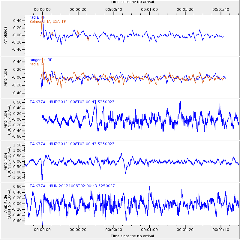
K37A Belmond, IA, USA - Earthquake Result Viewer
*The percent match for this event was below the threshold and hence no stack was calculated.
| Earthquake location: |
Chile-Bolivia Border Region |
| Earthquake latitude/longitude: |
-21.7/-68.2 |
| Earthquake time(UTC): |
2012/10/08 (282) 01:50:26 GMT |
| Earthquake Depth: |
122 km |
| Earthquake Magnitude: |
6.0 MB, 5.7 MW, 5.8 MW |
| Earthquake Catalog/Contributor: |
WHDF/NEIC |
|
| Network: |
TA USArray Transportable Network (new EarthScope stations) |
| Station: |
K37A Belmond, IA, USA |
| Lat/Lon: |
42.77 N/93.64 W |
| Elevation: |
365 m |
|
| Distance: |
68.3 deg |
| Az: |
340.075 deg |
| Baz: |
154.513 deg |
| Ray Param: |
$rayparam |
*The percent match for this event was below the threshold and hence was not used in the summary stack. |
|
| Radial Match: |
66.10948 % |
| Radial Bump: |
400 |
| Transverse Match: |
64.96198 % |
| Transverse Bump: |
400 |
| SOD ConfigId: |
478790 |
| Insert Time: |
2013-02-23 02:39:41.092 +0000 |
| GWidth: |
2.5 |
| Max Bumps: |
400 |
| Tol: |
0.001 |
|
Signal To Noise
| Channel | StoN | STA | LTA |
| TA:K37A: :BHZ:20121008T02:00:43.525002Z | 3.3723602 | 5.9868336E-7 | 1.7752652E-7 |
| TA:K37A: :BHN:20121008T02:00:43.525002Z | 1.2595038 | 2.636111E-7 | 2.0929757E-7 |
| TA:K37A: :BHE:20121008T02:00:43.525002Z | 2.9453454 | 3.297318E-7 | 1.1195012E-7 |
| Arrivals |
| Ps | |
| PpPs | |
| PsPs/PpSs | |


