You are here: Home > Network List > US - United States National Seismic Network Stations List
> Station HAWA Hanford, Washington, USA > Earthquake Result Viewer
HAWA Hanford, Washington, USA - Earthquake Result Viewer
*The percent match for this event was below the threshold and hence no stack was calculated.
| Earthquake location: |
North Of Panama |
| Earthquake latitude/longitude: |
11.7/-81.3 |
| Earthquake time(UTC): |
2014/06/16 (167) 13:26:46 GMT |
| Earthquake Depth: |
19 km |
| Earthquake Magnitude: |
5.3 MW |
| Earthquake Catalog/Contributor: |
ISC/ISC |
|
| Network: |
US United States National Seismic Network |
| Station: |
HAWA Hanford, Washington, USA |
| Lat/Lon: |
46.39 N/119.53 W |
| Elevation: |
364 m |
|
| Distance: |
47.3 deg |
| Az: |
324.362 deg |
| Baz: |
124.469 deg |
| Ray Param: |
$rayparam |
*The percent match for this event was below the threshold and hence was not used in the summary stack. |
|
| Radial Match: |
42.86953 % |
| Radial Bump: |
400 |
| Transverse Match: |
46.924698 % |
| Transverse Bump: |
400 |
| SOD ConfigId: |
3390531 |
| Insert Time: |
2019-04-12 07:41:03.426 +0000 |
| GWidth: |
2.5 |
| Max Bumps: |
400 |
| Tol: |
0.001 |
|
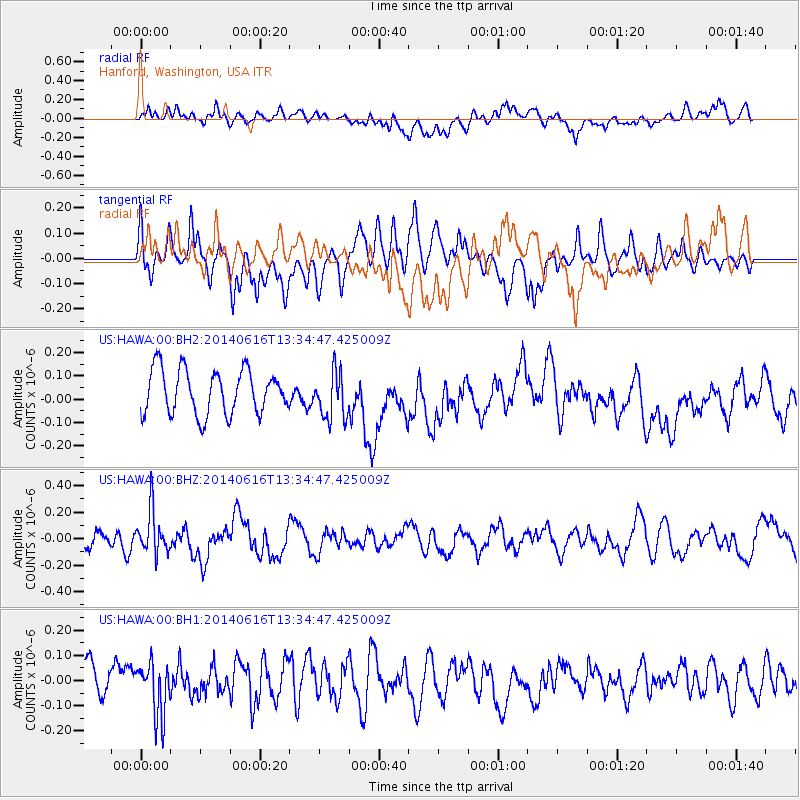
Signal To Noise
| Channel | StoN | STA | LTA |
| US:HAWA:00:BHZ:20140616T13:34:47.425009Z | 1.7898622 | 1.6265388E-7 | 9.087508E-8 |
| US:HAWA:00:BH1:20140616T13:34:47.425009Z | 1.5767937 | 1.0520301E-7 | 6.671957E-8 |
| US:HAWA:00:BH2:20140616T13:34:47.425009Z | 1.0747758 | 1.0139915E-7 | 9.434447E-8 |
| Arrivals |
| Ps | |
| PpPs | |
| PsPs/PpSs | |


