You are here: Home > Network List > TA - USArray Transportable Network (new EarthScope stations) Stations List
> Station K39A Oelwein, IA, USA > Earthquake Result Viewer
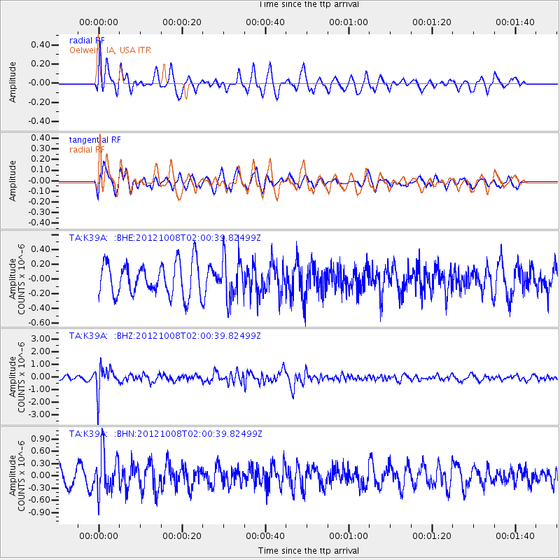
K39A Oelwein, IA, USA - Earthquake Result Viewer
*The percent match for this event was below the threshold and hence no stack was calculated.
| Earthquake location: |
Chile-Bolivia Border Region |
| Earthquake latitude/longitude: |
-21.7/-68.2 |
| Earthquake time(UTC): |
2012/10/08 (282) 01:50:26 GMT |
| Earthquake Depth: |
122 km |
| Earthquake Magnitude: |
6.0 MB, 5.7 MW, 5.8 MW |
| Earthquake Catalog/Contributor: |
WHDF/NEIC |
|
| Network: |
TA USArray Transportable Network (new EarthScope stations) |
| Station: |
K39A Oelwein, IA, USA |
| Lat/Lon: |
42.71 N/91.89 W |
| Elevation: |
332 m |
|
| Distance: |
67.7 deg |
| Az: |
341.311 deg |
| Baz: |
156.159 deg |
| Ray Param: |
$rayparam |
*The percent match for this event was below the threshold and hence was not used in the summary stack. |
|
| Radial Match: |
54.59394 % |
| Radial Bump: |
400 |
| Transverse Match: |
49.793213 % |
| Transverse Bump: |
400 |
| SOD ConfigId: |
478790 |
| Insert Time: |
2013-02-23 02:46:33.007 +0000 |
| GWidth: |
2.5 |
| Max Bumps: |
400 |
| Tol: |
0.001 |
|
Signal To Noise
| Channel | StoN | STA | LTA |
| TA:K39A: :BHZ:20121008T02:00:39.82499Z | 4.34072 | 1.0250011E-6 | 2.3613619E-7 |
| TA:K39A: :BHN:20121008T02:00:39.82499Z | 1.8325051 | 4.9586606E-7 | 2.7059465E-7 |
| TA:K39A: :BHE:20121008T02:00:39.82499Z | 1.2761935 | 2.8159835E-7 | 2.206549E-7 |
| Arrivals |
| Ps | |
| PpPs | |
| PsPs/PpSs | |


