You are here: Home > Network List > TA - USArray Transportable Network (new EarthScope stations) Stations List
> Station U41A Viola, AR, USA > Earthquake Result Viewer
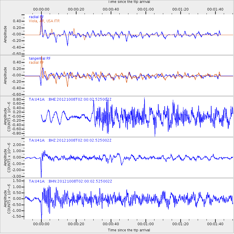
U41A Viola, AR, USA - Earthquake Result Viewer
*The percent match for this event was below the threshold and hence no stack was calculated.
| Earthquake location: |
Chile-Bolivia Border Region |
| Earthquake latitude/longitude: |
-21.7/-68.2 |
| Earthquake time(UTC): |
2012/10/08 (282) 01:50:26 GMT |
| Earthquake Depth: |
122 km |
| Earthquake Magnitude: |
6.0 MB, 5.7 MW, 5.8 MW |
| Earthquake Catalog/Contributor: |
WHDF/NEIC |
|
| Network: |
TA USArray Transportable Network (new EarthScope stations) |
| Station: |
U41A Viola, AR, USA |
| Lat/Lon: |
36.34 N/91.92 W |
| Elevation: |
300 m |
|
| Distance: |
62.0 deg |
| Az: |
338.379 deg |
| Baz: |
154.891 deg |
| Ray Param: |
$rayparam |
*The percent match for this event was below the threshold and hence was not used in the summary stack. |
|
| Radial Match: |
57.697144 % |
| Radial Bump: |
400 |
| Transverse Match: |
60.38825 % |
| Transverse Bump: |
400 |
| SOD ConfigId: |
478790 |
| Insert Time: |
2013-02-23 02:47:34.809 +0000 |
| GWidth: |
2.5 |
| Max Bumps: |
400 |
| Tol: |
0.001 |
|
Signal To Noise
| Channel | StoN | STA | LTA |
| TA:U41A: :BHZ:20121008T02:00:02.525002Z | 5.9538574 | 8.1899714E-7 | 1.3755741E-7 |
| TA:U41A: :BHN:20121008T02:00:02.525002Z | 3.6170874 | 6.6972353E-7 | 1.8515549E-7 |
| TA:U41A: :BHE:20121008T02:00:02.525002Z | 1.9461328 | 2.949995E-7 | 1.5158241E-7 |
| Arrivals |
| Ps | |
| PpPs | |
| PsPs/PpSs | |


