You are here: Home > Network List > UW - Pacific Northwest Regional Seismic Network Stations List
> Station MRBL Marblemount, WA, USA > Earthquake Result Viewer
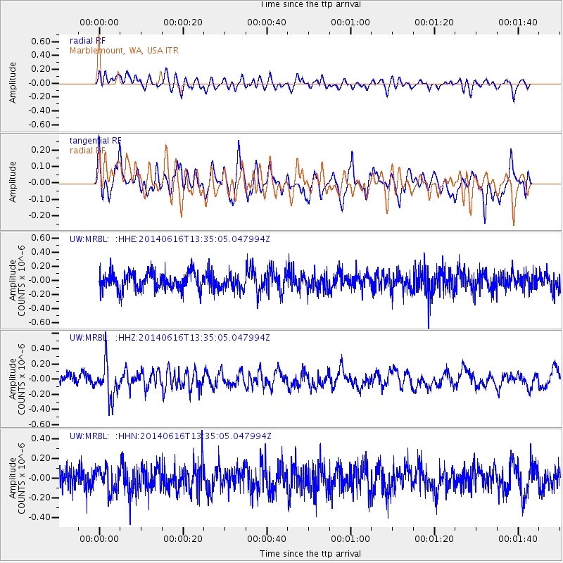
MRBL Marblemount, WA, USA - Earthquake Result Viewer
*The percent match for this event was below the threshold and hence no stack was calculated.
| Earthquake location: |
North Of Panama |
| Earthquake latitude/longitude: |
11.7/-81.3 |
| Earthquake time(UTC): |
2014/06/16 (167) 13:26:46 GMT |
| Earthquake Depth: |
19 km |
| Earthquake Magnitude: |
5.3 MW |
| Earthquake Catalog/Contributor: |
ISC/ISC |
|
| Network: |
UW Pacific Northwest Regional Seismic Network |
| Station: |
MRBL Marblemount, WA, USA |
| Lat/Lon: |
48.52 N/121.48 W |
| Elevation: |
75 m |
|
| Distance: |
49.5 deg |
| Az: |
325.718 deg |
| Baz: |
123.936 deg |
| Ray Param: |
$rayparam |
*The percent match for this event was below the threshold and hence was not used in the summary stack. |
|
| Radial Match: |
42.129368 % |
| Radial Bump: |
400 |
| Transverse Match: |
56.223698 % |
| Transverse Bump: |
400 |
| SOD ConfigId: |
3390531 |
| Insert Time: |
2019-04-12 07:41:26.681 +0000 |
| GWidth: |
2.5 |
| Max Bumps: |
400 |
| Tol: |
0.001 |
|
Signal To Noise
| Channel | StoN | STA | LTA |
| UW:MRBL: :HHZ:20140616T13:35:05.047994Z | 2.957141 | 2.2718876E-7 | 7.682717E-8 |
| UW:MRBL: :HHN:20140616T13:35:05.047994Z | 0.899454 | 1.1777721E-7 | 1.3094301E-7 |
| UW:MRBL: :HHE:20140616T13:35:05.047994Z | 0.86093557 | 1.0666771E-7 | 1.2389745E-7 |
| Arrivals |
| Ps | |
| PpPs | |
| PsPs/PpSs | |


