You are here: Home > Network List > TA - USArray Transportable Network (new EarthScope stations) Stations List
> Station 353A Camilla, GA, USA > Earthquake Result Viewer
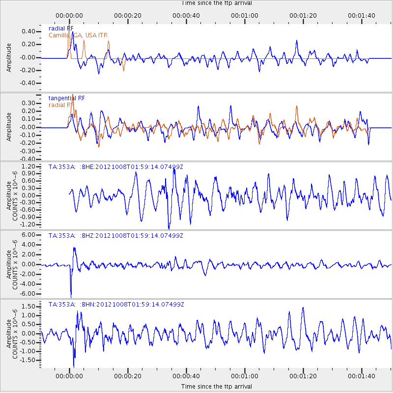
353A Camilla, GA, USA - Earthquake Result Viewer
*The percent match for this event was below the threshold and hence no stack was calculated.
| Earthquake location: |
Chile-Bolivia Border Region |
| Earthquake latitude/longitude: |
-21.7/-68.2 |
| Earthquake time(UTC): |
2012/10/08 (282) 01:50:26 GMT |
| Earthquake Depth: |
122 km |
| Earthquake Magnitude: |
6.0 MB, 5.7 MW, 5.8 MW |
| Earthquake Catalog/Contributor: |
WHDF/NEIC |
|
| Network: |
TA USArray Transportable Network (new EarthScope stations) |
| Station: |
353A Camilla, GA, USA |
| Lat/Lon: |
31.35 N/84.22 W |
| Elevation: |
54 m |
|
| Distance: |
55.0 deg |
| Az: |
343.207 deg |
| Baz: |
161.7 deg |
| Ray Param: |
$rayparam |
*The percent match for this event was below the threshold and hence was not used in the summary stack. |
|
| Radial Match: |
66.44806 % |
| Radial Bump: |
400 |
| Transverse Match: |
62.9657 % |
| Transverse Bump: |
400 |
| SOD ConfigId: |
478790 |
| Insert Time: |
2013-02-23 02:58:13.477 +0000 |
| GWidth: |
2.5 |
| Max Bumps: |
400 |
| Tol: |
0.001 |
|
Signal To Noise
| Channel | StoN | STA | LTA |
| TA:353A: :BHZ:20121008T01:59:14.07499Z | 7.2426763 | 1.9765464E-6 | 2.7290278E-7 |
| TA:353A: :BHN:20121008T01:59:14.07499Z | 1.7930847 | 7.1193983E-7 | 3.970475E-7 |
| TA:353A: :BHE:20121008T01:59:14.07499Z | 1.6722175 | 5.834029E-7 | 3.488798E-7 |
| Arrivals |
| Ps | |
| PpPs | |
| PsPs/PpSs | |


