You are here: Home > Network List > TA - USArray Transportable Network (new EarthScope stations) Stations List
> Station M51A Elyria, OH, USA > Earthquake Result Viewer
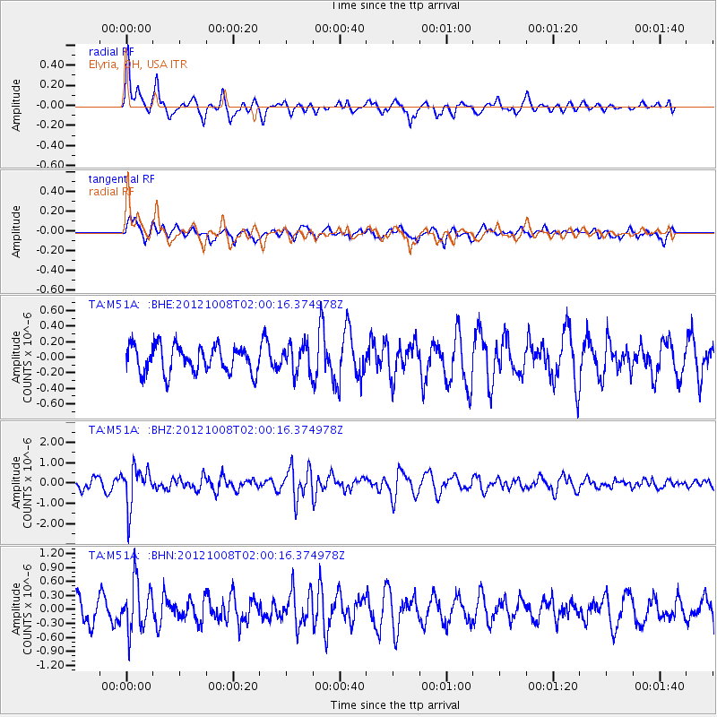
M51A Elyria, OH, USA - Earthquake Result Viewer
*The percent match for this event was below the threshold and hence no stack was calculated.
| Earthquake location: |
Chile-Bolivia Border Region |
| Earthquake latitude/longitude: |
-21.7/-68.2 |
| Earthquake time(UTC): |
2012/10/08 (282) 01:50:26 GMT |
| Earthquake Depth: |
122 km |
| Earthquake Magnitude: |
6.0 MB, 5.7 MW, 5.8 MW |
| Earthquake Catalog/Contributor: |
WHDF/NEIC |
|
| Network: |
TA USArray Transportable Network (new EarthScope stations) |
| Station: |
M51A Elyria, OH, USA |
| Lat/Lon: |
41.33 N/82.18 W |
| Elevation: |
239 m |
|
| Distance: |
64.1 deg |
| Az: |
348.297 deg |
| Baz: |
165.496 deg |
| Ray Param: |
$rayparam |
*The percent match for this event was below the threshold and hence was not used in the summary stack. |
|
| Radial Match: |
73.082275 % |
| Radial Bump: |
371 |
| Transverse Match: |
66.6939 % |
| Transverse Bump: |
400 |
| SOD ConfigId: |
478790 |
| Insert Time: |
2013-02-23 03:05:01.300 +0000 |
| GWidth: |
2.5 |
| Max Bumps: |
400 |
| Tol: |
0.001 |
|
Signal To Noise
| Channel | StoN | STA | LTA |
| TA:M51A: :BHZ:20121008T02:00:16.374978Z | 2.8522449 | 9.669074E-7 | 3.3899872E-7 |
| TA:M51A: :BHN:20121008T02:00:16.374978Z | 1.8459696 | 5.1989633E-7 | 2.8163862E-7 |
| TA:M51A: :BHE:20121008T02:00:16.374978Z | 1.0582126 | 1.8063905E-7 | 1.7070204E-7 |
| Arrivals |
| Ps | |
| PpPs | |
| PsPs/PpSs | |


