You are here: Home > Network List > TA - USArray Transportable Network (new EarthScope stations) Stations List
> Station L46A Eue Claire, MI, USA > Earthquake Result Viewer
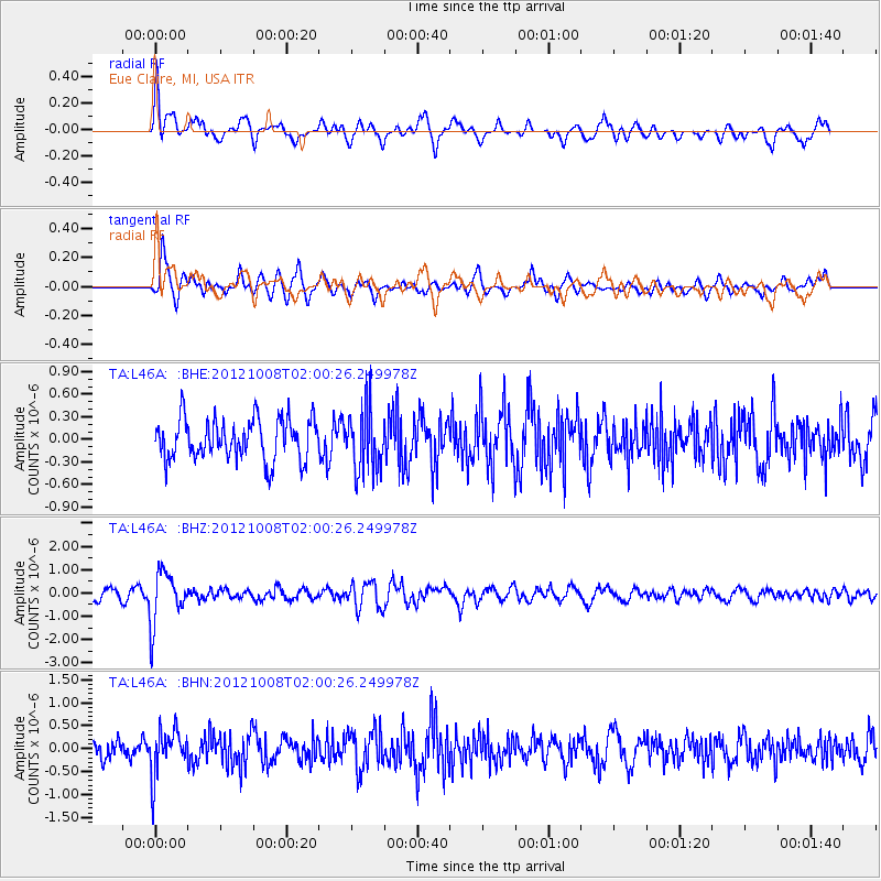
L46A Eue Claire, MI, USA - Earthquake Result Viewer
*The percent match for this event was below the threshold and hence no stack was calculated.
| Earthquake location: |
Chile-Bolivia Border Region |
| Earthquake latitude/longitude: |
-21.7/-68.2 |
| Earthquake time(UTC): |
2012/10/08 (282) 01:50:26 GMT |
| Earthquake Depth: |
122 km |
| Earthquake Magnitude: |
6.0 MB, 5.7 MW, 5.8 MW |
| Earthquake Catalog/Contributor: |
WHDF/NEIC |
|
| Network: |
TA USArray Transportable Network (new EarthScope stations) |
| Station: |
L46A Eue Claire, MI, USA |
| Lat/Lon: |
42.01 N/86.30 W |
| Elevation: |
223 m |
|
| Distance: |
65.6 deg |
| Az: |
345.247 deg |
| Baz: |
161.475 deg |
| Ray Param: |
$rayparam |
*The percent match for this event was below the threshold and hence was not used in the summary stack. |
|
| Radial Match: |
72.80509 % |
| Radial Bump: |
400 |
| Transverse Match: |
69.81404 % |
| Transverse Bump: |
400 |
| SOD ConfigId: |
478790 |
| Insert Time: |
2013-02-23 03:05:34.288 +0000 |
| GWidth: |
2.5 |
| Max Bumps: |
400 |
| Tol: |
0.001 |
|
Signal To Noise
| Channel | StoN | STA | LTA |
| TA:L46A: :BHZ:20121008T02:00:26.249978Z | 4.104336 | 1.1206517E-6 | 2.7304094E-7 |
| TA:L46A: :BHN:20121008T02:00:26.249978Z | 2.1296742 | 4.977757E-7 | 2.3373329E-7 |
| TA:L46A: :BHE:20121008T02:00:26.249978Z | 1.5459492 | 4.1434464E-7 | 2.6801956E-7 |
| Arrivals |
| Ps | |
| PpPs | |
| PsPs/PpSs | |


