You are here: Home > Network List > UW - Pacific Northwest Regional Seismic Network Stations List
> Station PASS Maple Falls, WA, USA > Earthquake Result Viewer
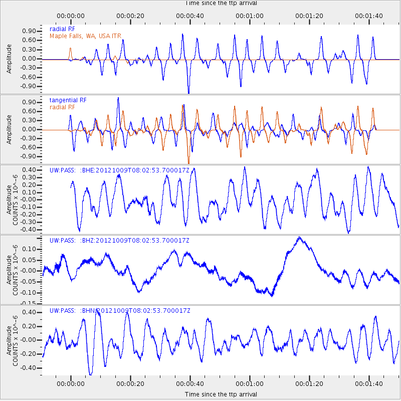
PASS Maple Falls, WA, USA - Earthquake Result Viewer
*The percent match for this event was below the threshold and hence no stack was calculated.
| Earthquake location: |
Near North Coast Of Irian Jaya |
| Earthquake latitude/longitude: |
-2.7/139.2 |
| Earthquake time(UTC): |
2012/10/09 (283) 07:49:51 GMT |
| Earthquake Depth: |
20 km |
| Earthquake Magnitude: |
5.6 MB, 5.4 MS, 5.6 MW |
| Earthquake Catalog/Contributor: |
WHDF/NEIC |
|
| Network: |
UW Pacific Northwest Regional Seismic Network |
| Station: |
PASS Maple Falls, WA, USA |
| Lat/Lon: |
49.00 N/122.09 W |
| Elevation: |
174 m |
|
| Distance: |
97.8 deg |
| Az: |
41.074 deg |
| Baz: |
274.778 deg |
| Ray Param: |
$rayparam |
*The percent match for this event was below the threshold and hence was not used in the summary stack. |
|
| Radial Match: |
49.42742 % |
| Radial Bump: |
400 |
| Transverse Match: |
50.994705 % |
| Transverse Bump: |
400 |
| SOD ConfigId: |
478790 |
| Insert Time: |
2013-02-23 03:14:47.858 +0000 |
| GWidth: |
2.5 |
| Max Bumps: |
400 |
| Tol: |
0.001 |
|
Signal To Noise
| Channel | StoN | STA | LTA |
| UW:PASS: :BHZ:20121009T08:02:53.700017Z | 0.8393773 | 1.2775139E-7 | 1.5219783E-7 |
| UW:PASS: :BHN:20121009T08:02:53.700017Z | 0.93111193 | 1.5543907E-7 | 1.6693917E-7 |
| UW:PASS: :BHE:20121009T08:02:53.700017Z | 1.2878629 | 2.16087E-7 | 1.6778728E-7 |
| Arrivals |
| Ps | |
| PpPs | |
| PsPs/PpSs | |


