You are here: Home > Network List > TA - USArray Transportable Network (new EarthScope stations) Stations List
> Station K36A Gilmore City, IA, USA > Earthquake Result Viewer
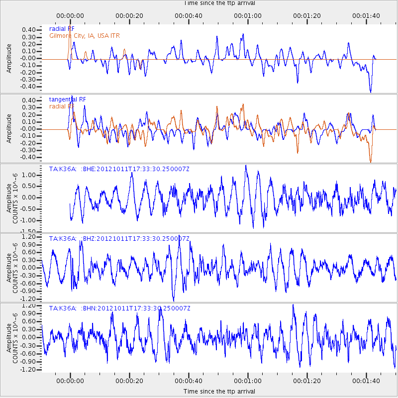
K36A Gilmore City, IA, USA - Earthquake Result Viewer
*The percent match for this event was below the threshold and hence no stack was calculated.
| Earthquake location: |
Chile-Argentina Border Region |
| Earthquake latitude/longitude: |
-32.9/-70.3 |
| Earthquake time(UTC): |
2012/10/11 (285) 17:22:09 GMT |
| Earthquake Depth: |
82 km |
| Earthquake Magnitude: |
5.5 MB, 5.5 MW, 5.6 MW |
| Earthquake Catalog/Contributor: |
WHDF/NEIC |
|
| Network: |
TA USArray Transportable Network (new EarthScope stations) |
| Station: |
K36A Gilmore City, IA, USA |
| Lat/Lon: |
42.64 N/94.45 W |
| Elevation: |
364 m |
|
| Distance: |
78.3 deg |
| Az: |
342.052 deg |
| Baz: |
159.423 deg |
| Ray Param: |
$rayparam |
*The percent match for this event was below the threshold and hence was not used in the summary stack. |
|
| Radial Match: |
48.83517 % |
| Radial Bump: |
400 |
| Transverse Match: |
62.077705 % |
| Transverse Bump: |
400 |
| SOD ConfigId: |
478790 |
| Insert Time: |
2013-02-23 03:20:32.389 +0000 |
| GWidth: |
2.5 |
| Max Bumps: |
400 |
| Tol: |
0.001 |
|
Signal To Noise
| Channel | StoN | STA | LTA |
| TA:K36A: :BHZ:20121011T17:33:30.250007Z | 2.171133 | 6.121311E-7 | 2.8194086E-7 |
| TA:K36A: :BHN:20121011T17:33:30.250007Z | 0.53296316 | 3.335556E-7 | 6.2585116E-7 |
| TA:K36A: :BHE:20121011T17:33:30.250007Z | 1.002375 | 4.5083604E-7 | 4.4976787E-7 |
| Arrivals |
| Ps | |
| PpPs | |
| PsPs/PpSs | |


