You are here: Home > Network List > TA - USArray Transportable Network (new EarthScope stations) Stations List
> Station L40A Anamosa, IA, USA > Earthquake Result Viewer
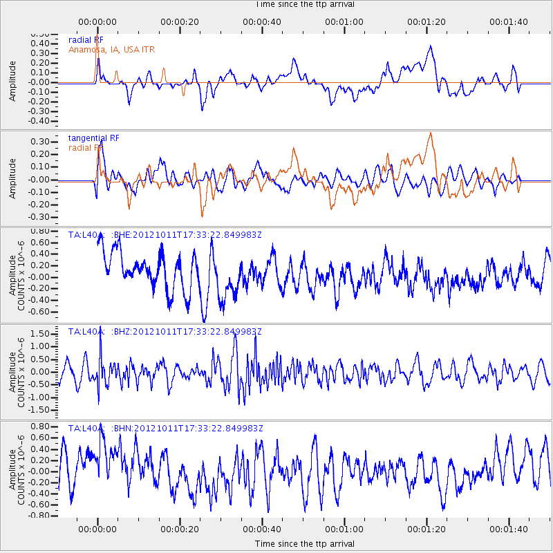
L40A Anamosa, IA, USA - Earthquake Result Viewer
*The percent match for this event was below the threshold and hence no stack was calculated.
| Earthquake location: |
Chile-Argentina Border Region |
| Earthquake latitude/longitude: |
-32.9/-70.3 |
| Earthquake time(UTC): |
2012/10/11 (285) 17:22:09 GMT |
| Earthquake Depth: |
82 km |
| Earthquake Magnitude: |
5.5 MB, 5.5 MW, 5.6 MW |
| Earthquake Catalog/Contributor: |
WHDF/NEIC |
|
| Network: |
TA USArray Transportable Network (new EarthScope stations) |
| Station: |
L40A Anamosa, IA, USA |
| Lat/Lon: |
42.06 N/91.22 W |
| Elevation: |
242 m |
|
| Distance: |
77.0 deg |
| Az: |
344.17 deg |
| Baz: |
162.043 deg |
| Ray Param: |
$rayparam |
*The percent match for this event was below the threshold and hence was not used in the summary stack. |
|
| Radial Match: |
34.236576 % |
| Radial Bump: |
400 |
| Transverse Match: |
51.595592 % |
| Transverse Bump: |
400 |
| SOD ConfigId: |
478790 |
| Insert Time: |
2013-02-23 03:23:08.139 +0000 |
| GWidth: |
2.5 |
| Max Bumps: |
400 |
| Tol: |
0.001 |
|
Signal To Noise
| Channel | StoN | STA | LTA |
| TA:L40A: :BHZ:20121011T17:33:22.849983Z | 2.4085805 | 5.2849026E-7 | 2.194198E-7 |
| TA:L40A: :BHN:20121011T17:33:22.849983Z | 1.7137526 | 6.427512E-7 | 3.7505484E-7 |
| TA:L40A: :BHE:20121011T17:33:22.849983Z | 1.3549392 | 4.2185798E-7 | 3.1134823E-7 |
| Arrivals |
| Ps | |
| PpPs | |
| PsPs/PpSs | |


