You are here: Home > Network List > TA - USArray Transportable Network (new EarthScope stations) Stations List
> Station P47A Martinsville, IN, USA > Earthquake Result Viewer
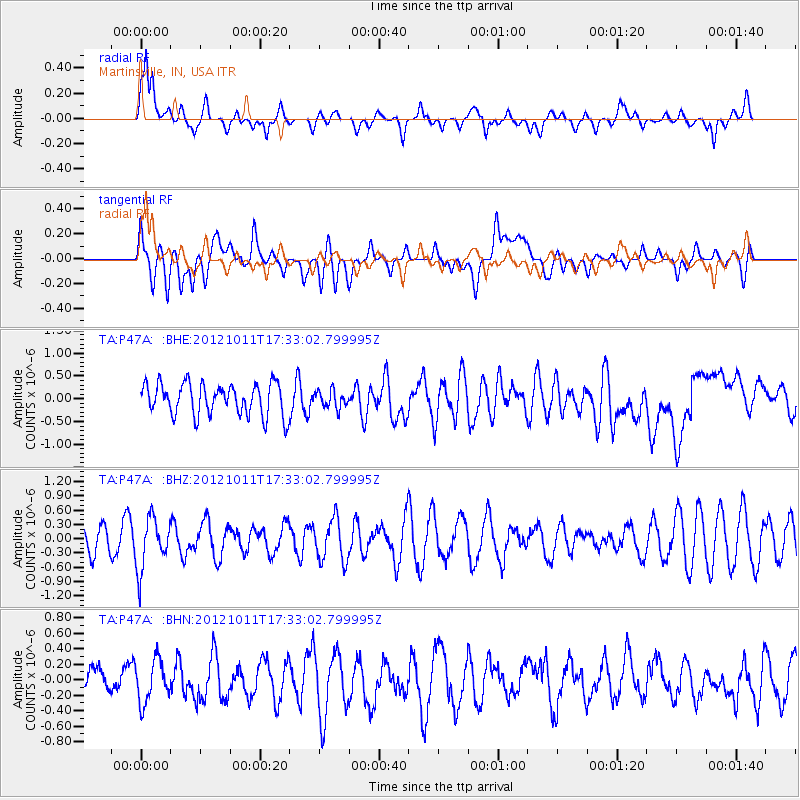
P47A Martinsville, IN, USA - Earthquake Result Viewer
*The percent match for this event was below the threshold and hence no stack was calculated.
| Earthquake location: |
Chile-Argentina Border Region |
| Earthquake latitude/longitude: |
-32.9/-70.3 |
| Earthquake time(UTC): |
2012/10/11 (285) 17:22:09 GMT |
| Earthquake Depth: |
82 km |
| Earthquake Magnitude: |
5.5 MB, 5.5 MW, 5.6 MW |
| Earthquake Catalog/Contributor: |
WHDF/NEIC |
|
| Network: |
TA USArray Transportable Network (new EarthScope stations) |
| Station: |
P47A Martinsville, IN, USA |
| Lat/Lon: |
39.49 N/86.27 W |
| Elevation: |
246 m |
|
| Distance: |
73.5 deg |
| Az: |
347.178 deg |
| Baz: |
166.034 deg |
| Ray Param: |
$rayparam |
*The percent match for this event was below the threshold and hence was not used in the summary stack. |
|
| Radial Match: |
55.176346 % |
| Radial Bump: |
400 |
| Transverse Match: |
38.733925 % |
| Transverse Bump: |
400 |
| SOD ConfigId: |
478790 |
| Insert Time: |
2013-02-23 03:23:53.870 +0000 |
| GWidth: |
2.5 |
| Max Bumps: |
400 |
| Tol: |
0.001 |
|
Signal To Noise
| Channel | StoN | STA | LTA |
| TA:P47A: :BHZ:20121011T17:33:02.799995Z | 2.4102464 | 5.407745E-7 | 2.2436484E-7 |
| TA:P47A: :BHN:20121011T17:33:02.799995Z | 0.67261696 | 2.7105347E-7 | 4.029834E-7 |
| TA:P47A: :BHE:20121011T17:33:02.799995Z | 0.5470264 | 1.8986695E-7 | 3.470892E-7 |
| Arrivals |
| Ps | |
| PpPs | |
| PsPs/PpSs | |


