You are here: Home > Network List > TA - USArray Transportable Network (new EarthScope stations) Stations List
> Station X48A Hartselle, AL, USA > Earthquake Result Viewer
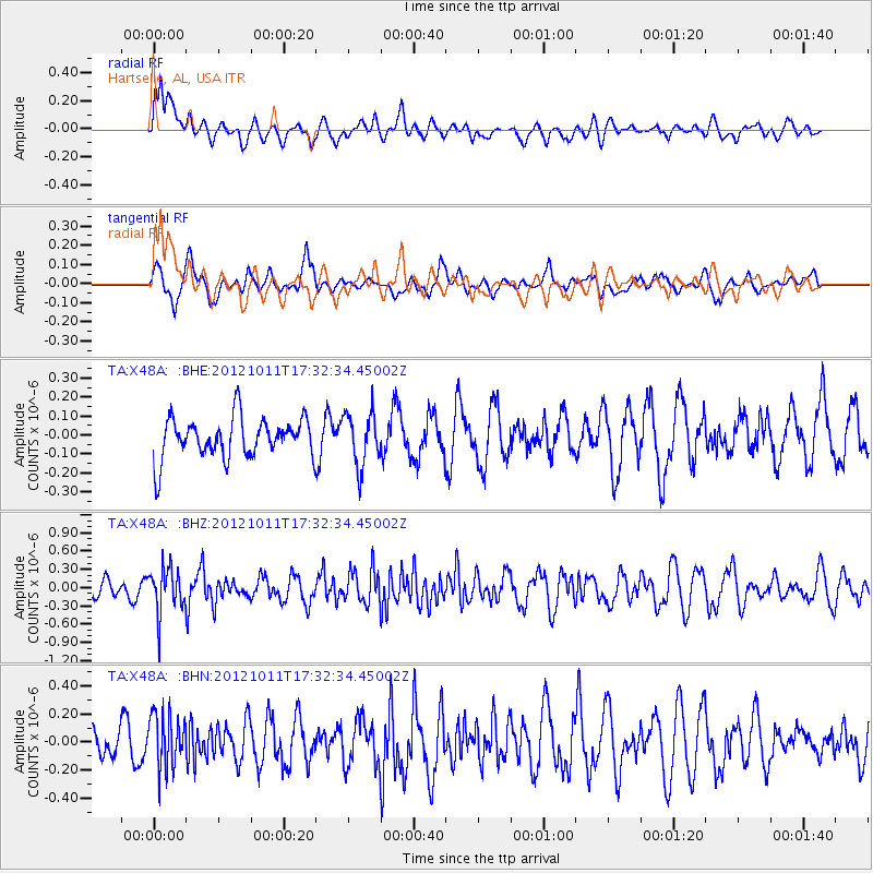
X48A Hartselle, AL, USA - Earthquake Result Viewer
*The percent match for this event was below the threshold and hence no stack was calculated.
| Earthquake location: |
Chile-Argentina Border Region |
| Earthquake latitude/longitude: |
-32.9/-70.3 |
| Earthquake time(UTC): |
2012/10/11 (285) 17:22:09 GMT |
| Earthquake Depth: |
82 km |
| Earthquake Magnitude: |
5.5 MB, 5.5 MW, 5.6 MW |
| Earthquake Catalog/Contributor: |
WHDF/NEIC |
|
| Network: |
TA USArray Transportable Network (new EarthScope stations) |
| Station: |
X48A Hartselle, AL, USA |
| Lat/Lon: |
34.45 N/87.05 W |
| Elevation: |
180 m |
|
| Distance: |
68.8 deg |
| Az: |
345.211 deg |
| Baz: |
164.932 deg |
| Ray Param: |
$rayparam |
*The percent match for this event was below the threshold and hence was not used in the summary stack. |
|
| Radial Match: |
47.91065 % |
| Radial Bump: |
400 |
| Transverse Match: |
67.65667 % |
| Transverse Bump: |
400 |
| SOD ConfigId: |
478790 |
| Insert Time: |
2013-02-23 03:24:16.579 +0000 |
| GWidth: |
2.5 |
| Max Bumps: |
400 |
| Tol: |
0.001 |
|
Signal To Noise
| Channel | StoN | STA | LTA |
| TA:X48A: :BHZ:20121011T17:32:34.45002Z | 3.2063494 | 3.63318E-7 | 1.1331204E-7 |
| TA:X48A: :BHN:20121011T17:32:34.45002Z | 1.8754778 | 1.875636E-7 | 1.00008435E-7 |
| TA:X48A: :BHE:20121011T17:32:34.45002Z | 1.3345479 | 1.4072641E-7 | 1.05448756E-7 |
| Arrivals |
| Ps | |
| PpPs | |
| PsPs/PpSs | |


