You are here: Home > Network List > TA - USArray Transportable Network (new EarthScope stations) Stations List
> Station V49A McMinnville, TN, USA > Earthquake Result Viewer
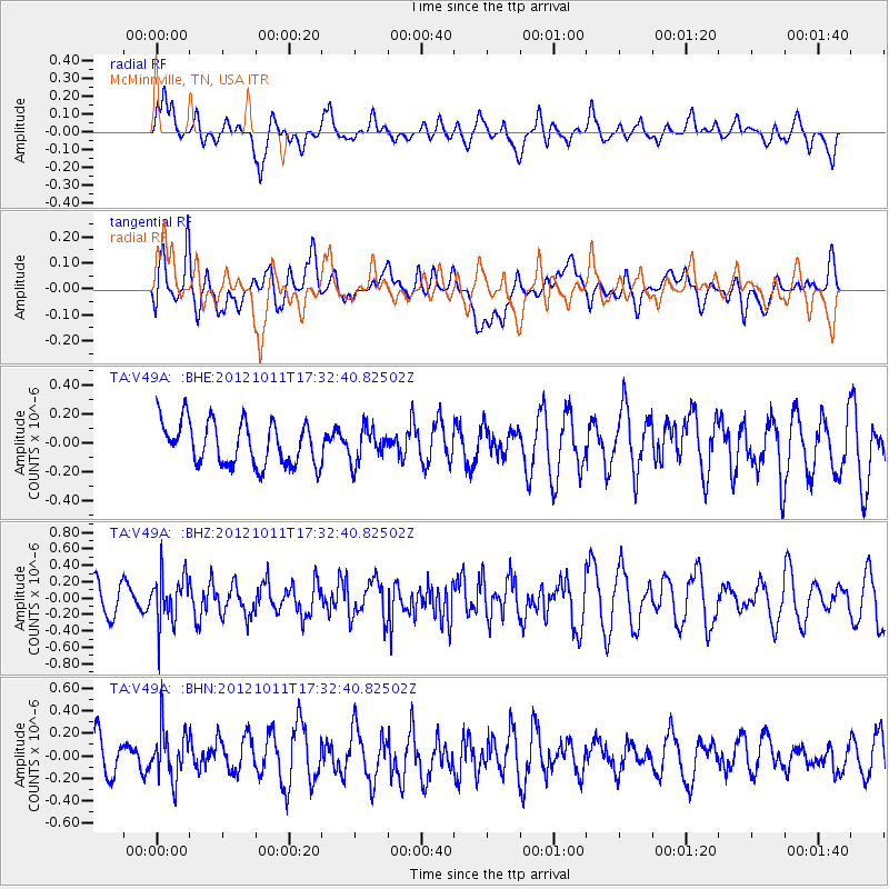
V49A McMinnville, TN, USA - Earthquake Result Viewer
*The percent match for this event was below the threshold and hence no stack was calculated.
| Earthquake location: |
Chile-Argentina Border Region |
| Earthquake latitude/longitude: |
-32.9/-70.3 |
| Earthquake time(UTC): |
2012/10/11 (285) 17:22:09 GMT |
| Earthquake Depth: |
82 km |
| Earthquake Magnitude: |
5.5 MB, 5.5 MW, 5.6 MW |
| Earthquake Catalog/Contributor: |
WHDF/NEIC |
|
| Network: |
TA USArray Transportable Network (new EarthScope stations) |
| Station: |
V49A McMinnville, TN, USA |
| Lat/Lon: |
35.77 N/85.90 W |
| Elevation: |
329 m |
|
| Distance: |
69.8 deg |
| Az: |
346.532 deg |
| Baz: |
166.053 deg |
| Ray Param: |
$rayparam |
*The percent match for this event was below the threshold and hence was not used in the summary stack. |
|
| Radial Match: |
49.795197 % |
| Radial Bump: |
400 |
| Transverse Match: |
58.77334 % |
| Transverse Bump: |
400 |
| SOD ConfigId: |
478790 |
| Insert Time: |
2013-02-23 03:26:00.864 +0000 |
| GWidth: |
2.5 |
| Max Bumps: |
400 |
| Tol: |
0.001 |
|
Signal To Noise
| Channel | StoN | STA | LTA |
| TA:V49A: :BHZ:20121011T17:32:40.82502Z | 2.077583 | 2.943064E-7 | 1.4165806E-7 |
| TA:V49A: :BHN:20121011T17:32:40.82502Z | 1.5924805 | 2.2083883E-7 | 1.38676E-7 |
| TA:V49A: :BHE:20121011T17:32:40.82502Z | 0.7853825 | 1.174661E-7 | 1.4956547E-7 |
| Arrivals |
| Ps | |
| PpPs | |
| PsPs/PpSs | |


