You are here: Home > Network List > CI - Caltech Regional Seismic Network Stations List
> Station BAR Barrett, Tecate, CA, USA > Earthquake Result Viewer
BAR Barrett, Tecate, CA, USA - Earthquake Result Viewer
*The percent match for this event was below the threshold and hence no stack was calculated.
| Earthquake location: |
Solomon Islands |
| Earthquake latitude/longitude: |
-7.1/156.0 |
| Earthquake time(UTC): |
2012/10/14 (288) 04:58:04 GMT |
| Earthquake Depth: |
37 km |
| Earthquake Magnitude: |
5.8 MB, 5.5 MS, 5.8 MW, 5.8 MW |
| Earthquake Catalog/Contributor: |
WHDF/NEIC |
|
| Network: |
CI Caltech Regional Seismic Network |
| Station: |
BAR Barrett, Tecate, CA, USA |
| Lat/Lon: |
32.68 N/116.67 W |
| Elevation: |
521 m |
|
| Distance: |
91.5 deg |
| Az: |
57.425 deg |
| Baz: |
262.556 deg |
| Ray Param: |
$rayparam |
*The percent match for this event was below the threshold and hence was not used in the summary stack. |
|
| Radial Match: |
66.58712 % |
| Radial Bump: |
400 |
| Transverse Match: |
54.9846 % |
| Transverse Bump: |
400 |
| SOD ConfigId: |
478790 |
| Insert Time: |
2013-02-23 03:31:18.872 +0000 |
| GWidth: |
2.5 |
| Max Bumps: |
400 |
| Tol: |
0.001 |
|
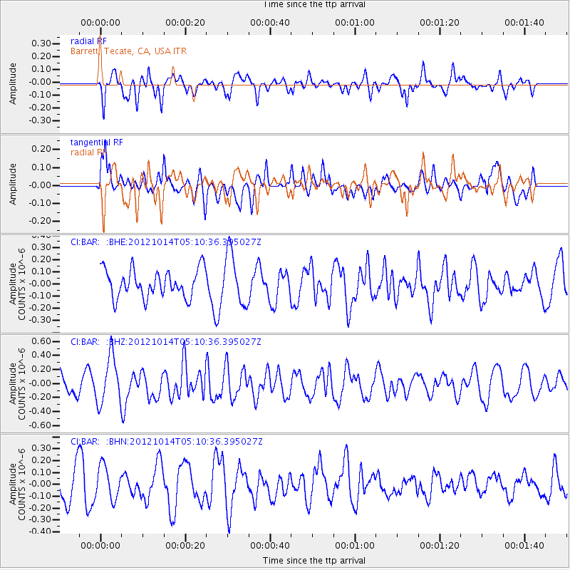
Signal To Noise
| Channel | StoN | STA | LTA |
| CI:BAR: :BHZ:20121014T05:10:36.395027Z | 2.169273 | 3.4686005E-7 | 1.5989691E-7 |
| CI:BAR: :BHN:20121014T05:10:36.395027Z | 1.1913819 | 1.4756519E-7 | 1.2386053E-7 |
| CI:BAR: :BHE:20121014T05:10:36.395027Z | 1.8956126 | 2.1350462E-7 | 1.12630936E-7 |
| Arrivals |
| Ps | |
| PpPs | |
| PsPs/PpSs | |


