You are here: Home > Network List > TA - USArray Transportable Network (new EarthScope stations) Stations List
> Station R11A Troy Canyon, Currant, NV, USA > Earthquake Result Viewer
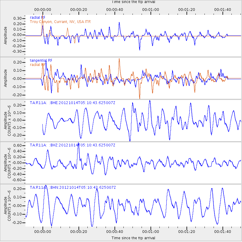
R11A Troy Canyon, Currant, NV, USA - Earthquake Result Viewer
*The percent match for this event was below the threshold and hence no stack was calculated.
| Earthquake location: |
Solomon Islands |
| Earthquake latitude/longitude: |
-7.1/156.0 |
| Earthquake time(UTC): |
2012/10/14 (288) 04:58:04 GMT |
| Earthquake Depth: |
37 km |
| Earthquake Magnitude: |
5.8 MB, 5.5 MS, 5.8 MW, 5.8 MW |
| Earthquake Catalog/Contributor: |
WHDF/NEIC |
|
| Network: |
TA USArray Transportable Network (new EarthScope stations) |
| Station: |
R11A Troy Canyon, Currant, NV, USA |
| Lat/Lon: |
38.35 N/115.59 W |
| Elevation: |
1756 m |
|
| Distance: |
93.1 deg |
| Az: |
51.916 deg |
| Baz: |
263.408 deg |
| Ray Param: |
$rayparam |
*The percent match for this event was below the threshold and hence was not used in the summary stack. |
|
| Radial Match: |
53.01879 % |
| Radial Bump: |
319 |
| Transverse Match: |
48.44163 % |
| Transverse Bump: |
400 |
| SOD ConfigId: |
478790 |
| Insert Time: |
2013-02-23 03:34:29.229 +0000 |
| GWidth: |
2.5 |
| Max Bumps: |
400 |
| Tol: |
0.001 |
|
Signal To Noise
| Channel | StoN | STA | LTA |
| TA:R11A: :BHZ:20121014T05:10:43.625007Z | 2.156566 | 2.1690347E-7 | 1.0057818E-7 |
| TA:R11A: :BHN:20121014T05:10:43.625007Z | 3.1778066 | 1.6902762E-7 | 5.3190025E-8 |
| TA:R11A: :BHE:20121014T05:10:43.625007Z | 0.9203556 | 8.5115644E-8 | 9.248126E-8 |
| Arrivals |
| Ps | |
| PpPs | |
| PsPs/PpSs | |


