You are here: Home > Network List > TA - USArray Transportable Network (new EarthScope stations) Stations List
> Station TPFO Pinon Flats, CA, USA > Earthquake Result Viewer
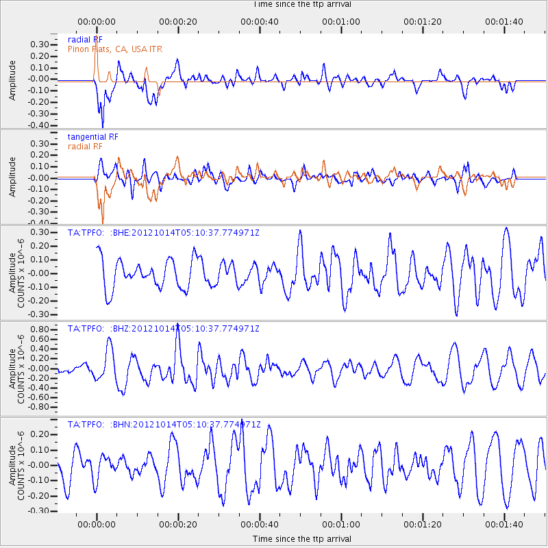
TPFO Pinon Flats, CA, USA - Earthquake Result Viewer
*The percent match for this event was below the threshold and hence no stack was calculated.
| Earthquake location: |
Solomon Islands |
| Earthquake latitude/longitude: |
-7.1/156.0 |
| Earthquake time(UTC): |
2012/10/14 (288) 04:58:04 GMT |
| Earthquake Depth: |
37 km |
| Earthquake Magnitude: |
5.8 MB, 5.5 MS, 5.8 MW, 5.8 MW |
| Earthquake Catalog/Contributor: |
WHDF/NEIC |
|
| Network: |
TA USArray Transportable Network (new EarthScope stations) |
| Station: |
TPFO Pinon Flats, CA, USA |
| Lat/Lon: |
33.61 N/116.45 W |
| Elevation: |
1275 m |
|
| Distance: |
91.8 deg |
| Az: |
56.533 deg |
| Baz: |
262.701 deg |
| Ray Param: |
$rayparam |
*The percent match for this event was below the threshold and hence was not used in the summary stack. |
|
| Radial Match: |
50.14099 % |
| Radial Bump: |
400 |
| Transverse Match: |
55.36323 % |
| Transverse Bump: |
400 |
| SOD ConfigId: |
478790 |
| Insert Time: |
2013-02-23 03:34:42.373 +0000 |
| GWidth: |
2.5 |
| Max Bumps: |
400 |
| Tol: |
0.001 |
|
Signal To Noise
| Channel | StoN | STA | LTA |
| TA:TPFO: :BHZ:20121014T05:10:37.774971Z | 3.3791952 | 3.3593972E-7 | 9.9414116E-8 |
| TA:TPFO: :BHN:20121014T05:10:37.774971Z | 0.65087426 | 7.981237E-8 | 1.2262332E-7 |
| TA:TPFO: :BHE:20121014T05:10:37.774971Z | 0.6894109 | 7.3004436E-8 | 1.0589394E-7 |
| Arrivals |
| Ps | |
| PpPs | |
| PsPs/PpSs | |


