You are here: Home > Network List > UW - Pacific Northwest Regional Seismic Network Stations List
> Station PASS Maple Falls, WA, USA > Earthquake Result Viewer
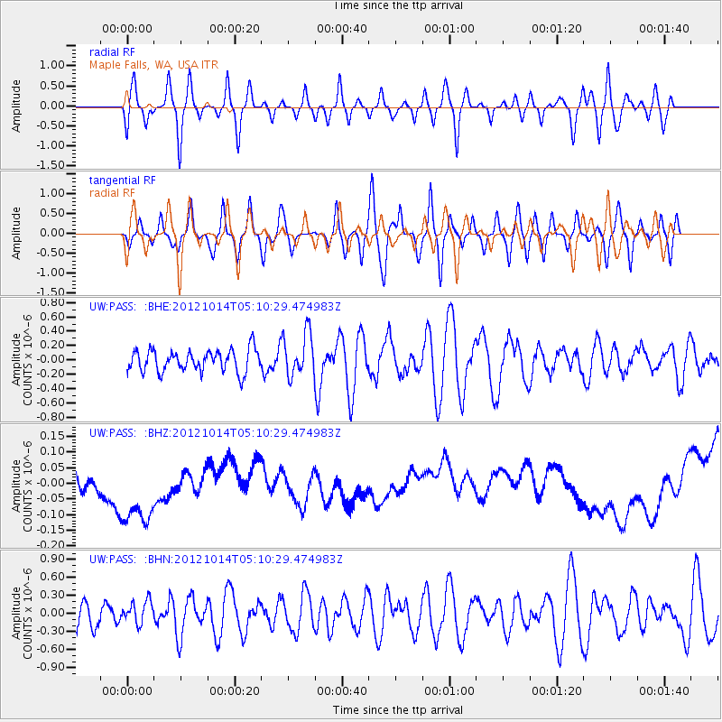
PASS Maple Falls, WA, USA - Earthquake Result Viewer
*The percent match for this event was below the threshold and hence no stack was calculated.
| Earthquake location: |
Solomon Islands |
| Earthquake latitude/longitude: |
-7.1/156.0 |
| Earthquake time(UTC): |
2012/10/14 (288) 04:58:04 GMT |
| Earthquake Depth: |
37 km |
| Earthquake Magnitude: |
5.8 MB, 5.5 MS, 5.8 MW, 5.8 MW |
| Earthquake Catalog/Contributor: |
WHDF/NEIC |
|
| Network: |
UW Pacific Northwest Regional Seismic Network |
| Station: |
PASS Maple Falls, WA, USA |
| Lat/Lon: |
49.00 N/122.09 W |
| Elevation: |
174 m |
|
| Distance: |
90.0 deg |
| Az: |
40.69 deg |
| Baz: |
259.221 deg |
| Ray Param: |
$rayparam |
*The percent match for this event was below the threshold and hence was not used in the summary stack. |
|
| Radial Match: |
41.62179 % |
| Radial Bump: |
400 |
| Transverse Match: |
41.32192 % |
| Transverse Bump: |
400 |
| SOD ConfigId: |
478790 |
| Insert Time: |
2013-02-23 03:35:30.127 +0000 |
| GWidth: |
2.5 |
| Max Bumps: |
400 |
| Tol: |
0.001 |
|
Signal To Noise
| Channel | StoN | STA | LTA |
| UW:PASS: :BHZ:20121014T05:10:29.474983Z | 2.0082552 | 2.0054428E-7 | 9.985995E-8 |
| UW:PASS: :BHN:20121014T05:10:29.474983Z | 0.8215733 | 1.8558111E-7 | 2.2588503E-7 |
| UW:PASS: :BHE:20121014T05:10:29.474983Z | 1.9937965 | 3.0522082E-7 | 1.5308525E-7 |
| Arrivals |
| Ps | |
| PpPs | |
| PsPs/PpSs | |


