You are here: Home > Network List > CI - Caltech Regional Seismic Network Stations List
> Station SHO Shoshone, CA, USA > Earthquake Result Viewer
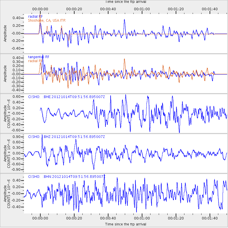
SHO Shoshone, CA, USA - Earthquake Result Viewer
*The percent match for this event was below the threshold and hence no stack was calculated.
| Earthquake location: |
Kuril Islands |
| Earthquake latitude/longitude: |
48.3/154.4 |
| Earthquake time(UTC): |
2012/10/14 (288) 09:41:58 GMT |
| Earthquake Depth: |
35 km |
| Earthquake Magnitude: |
5.7 MB, 5.2 MS, 5.7 MW, 5.7 MW |
| Earthquake Catalog/Contributor: |
WHDF/NEIC |
|
| Network: |
CI Caltech Regional Seismic Network |
| Station: |
SHO Shoshone, CA, USA |
| Lat/Lon: |
35.90 N/116.28 W |
| Elevation: |
451 m |
|
| Distance: |
63.8 deg |
| Az: |
64.783 deg |
| Baz: |
311.934 deg |
| Ray Param: |
$rayparam |
*The percent match for this event was below the threshold and hence was not used in the summary stack. |
|
| Radial Match: |
63.793144 % |
| Radial Bump: |
400 |
| Transverse Match: |
76.31675 % |
| Transverse Bump: |
400 |
| SOD ConfigId: |
478790 |
| Insert Time: |
2013-02-23 03:40:53.672 +0000 |
| GWidth: |
2.5 |
| Max Bumps: |
400 |
| Tol: |
0.001 |
|
Signal To Noise
| Channel | StoN | STA | LTA |
| CI:SHO: :BHZ:20121014T09:51:56.895007Z | 3.5960395 | 3.997745E-7 | 1.1117077E-7 |
| CI:SHO: :BHN:20121014T09:51:56.895007Z | 1.7010776 | 1.5231855E-7 | 8.954238E-8 |
| CI:SHO: :BHE:20121014T09:51:56.895007Z | 2.1484237 | 2.4535407E-7 | 1.14201896E-7 |
| Arrivals |
| Ps | |
| PpPs | |
| PsPs/PpSs | |


