You are here: Home > Network List > CI - Caltech Regional Seismic Network Stations List
> Station SMM Simmler, CA, USA > Earthquake Result Viewer
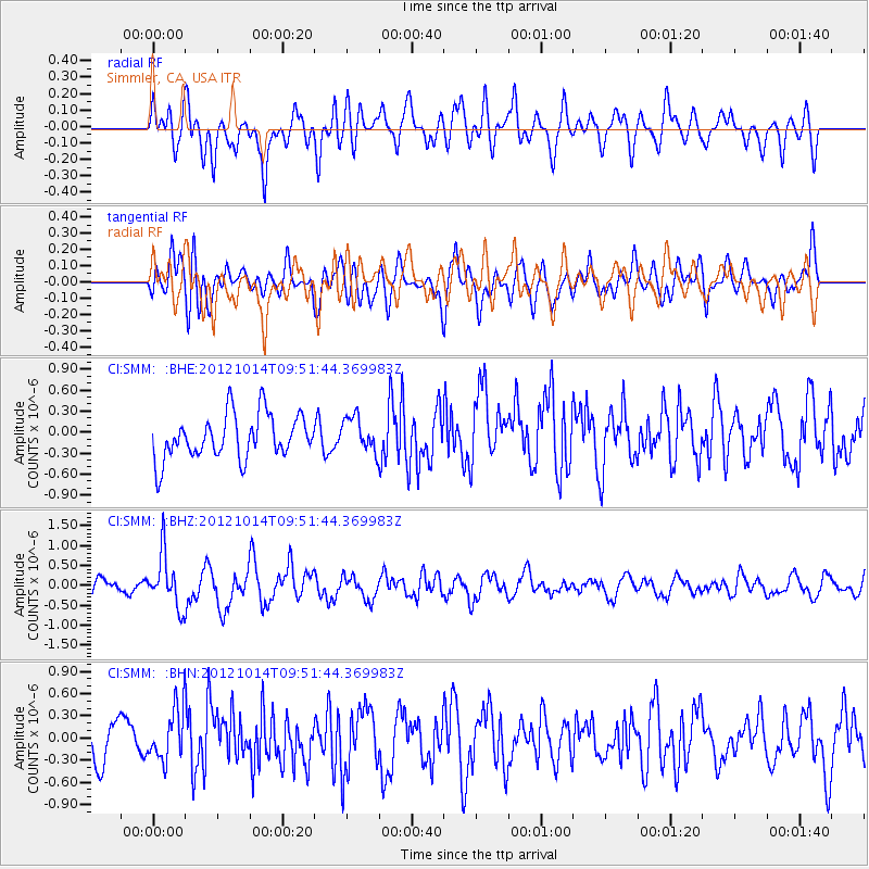
SMM Simmler, CA, USA - Earthquake Result Viewer
*The percent match for this event was below the threshold and hence no stack was calculated.
| Earthquake location: |
Kuril Islands |
| Earthquake latitude/longitude: |
48.3/154.4 |
| Earthquake time(UTC): |
2012/10/14 (288) 09:41:58 GMT |
| Earthquake Depth: |
35 km |
| Earthquake Magnitude: |
5.7 MB, 5.2 MS, 5.7 MW, 5.7 MW |
| Earthquake Catalog/Contributor: |
WHDF/NEIC |
|
| Network: |
CI Caltech Regional Seismic Network |
| Station: |
SMM Simmler, CA, USA |
| Lat/Lon: |
35.31 N/120.00 W |
| Elevation: |
599 m |
|
| Distance: |
61.9 deg |
| Az: |
67.531 deg |
| Baz: |
311.03 deg |
| Ray Param: |
$rayparam |
*The percent match for this event was below the threshold and hence was not used in the summary stack. |
|
| Radial Match: |
64.927605 % |
| Radial Bump: |
400 |
| Transverse Match: |
50.731983 % |
| Transverse Bump: |
400 |
| SOD ConfigId: |
478790 |
| Insert Time: |
2013-02-23 03:42:05.159 +0000 |
| GWidth: |
2.5 |
| Max Bumps: |
400 |
| Tol: |
0.001 |
|
Signal To Noise
| Channel | StoN | STA | LTA |
| CI:SMM: :BHZ:20121014T09:51:44.369983Z | 2.5871942 | 6.6599483E-7 | 2.574197E-7 |
| CI:SMM: :BHN:20121014T09:51:44.369983Z | 0.7832688 | 3.5052733E-7 | 4.4751854E-7 |
| CI:SMM: :BHE:20121014T09:51:44.369983Z | 0.7958218 | 2.502739E-7 | 3.1448488E-7 |
| Arrivals |
| Ps | |
| PpPs | |
| PsPs/PpSs | |


